Winter Island Park Pathway and Bank Restoration
Winter Island Park Pathway and Bank Restoration
**For Project Updates Please See Below**
Objective:
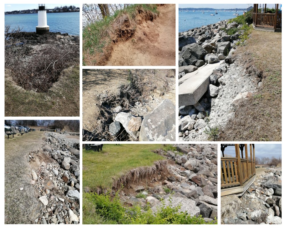
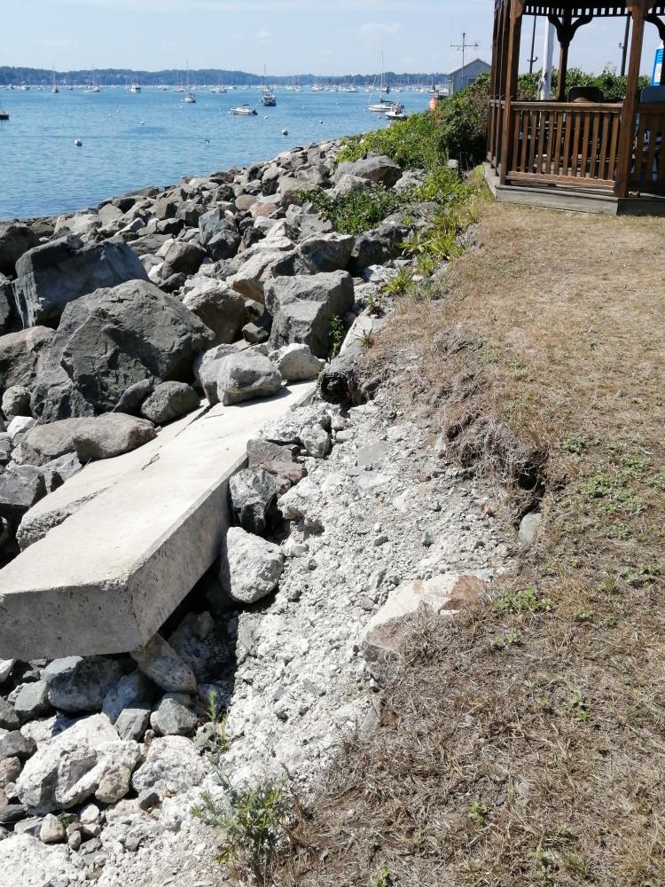
The Winter Island Park Pathway and Bank Restoration Project will help address the severe and ongoing issue of erosion of its pathways and coastal banks, resulting from its unconstrained use and from climate change. Coastal erosion, combined with excess invasive bittersweet, at Winter Island Park threatens the Park’s goals to “enhance its unique natural resources, preserve its historically significant properties, and increase the public’s access and enjoyment.”
The project will focus on managing the heavy, undirected pedestrian use of the coastal bank and assess how the eroding banks and pathways can best stabilized. Managing the year-round pedestrian use of the park is the critical first step. The project aims to find solutions to this problem through community engagement and physical actions at Winter Island Park. Additionally, the area will be evaluated to begin the ecological restoration of the coastal bank process.
Here are some photographs of the areas in queston. (Photos taken 2019 through Spring 2023)
Should you have any questions about this project please reach out to the Signature Parks Project Manager, Mike Crounse at mcrounse@salem.com or
Barbara Warren of Salem Sound Coast Watch at barbara.warren@salemsound.org
Update 5/14/2024 - (Pamphlet)
Winter Island Park Pathway and Bank Restoration Project
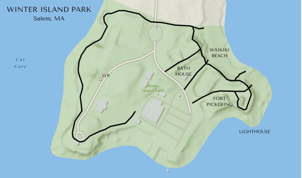
A resilience project focused on coastal bank and trail erosion around Fort Pickering and Waikiki Beach, Salem, MA
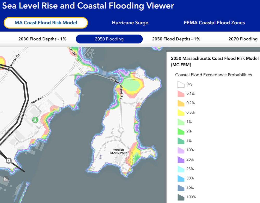
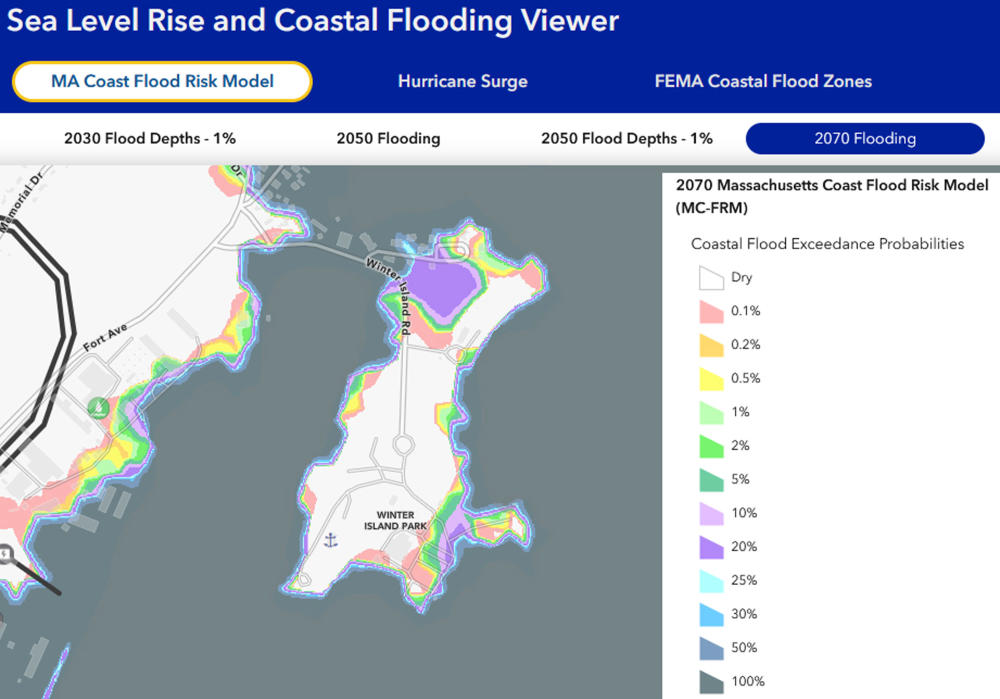
ACCELERATING EROSION FROM CLIMATE CHANGE
The project will help address the severe and ongoing issue of erosion of the Winter Island Park pathways and coastal banks. It will focus on managing path access and assessing how best to stabilize the eroding banks and trails.
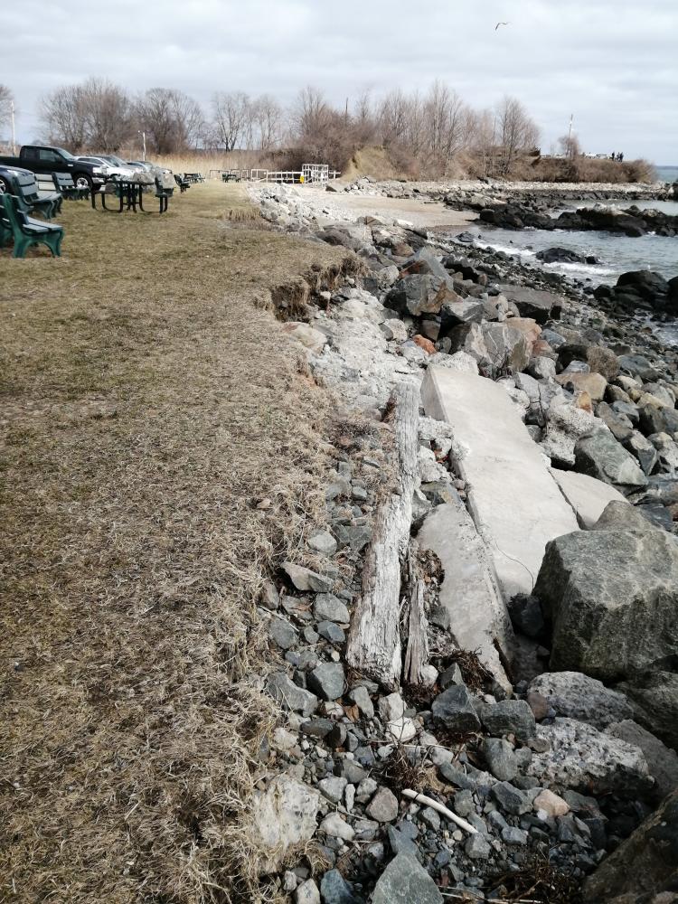
Photo caption: Erosion of the coastal bank from storm surge and increased sea level associated with climate change
Winter Island’s eroding banks and trails are a visible impact of recreational use in a changing climate. Local sea level has risen over 8 inches since 1950 and the rate of rise is accelerating. Warmer air and ocean water fuel stronger coastal storms with damaging storm surge and waves. Warmer air also holds more moisture, which falls as heavy rain and contributes to trail erosion.
WHY IS THIS AREA SPECIAL?
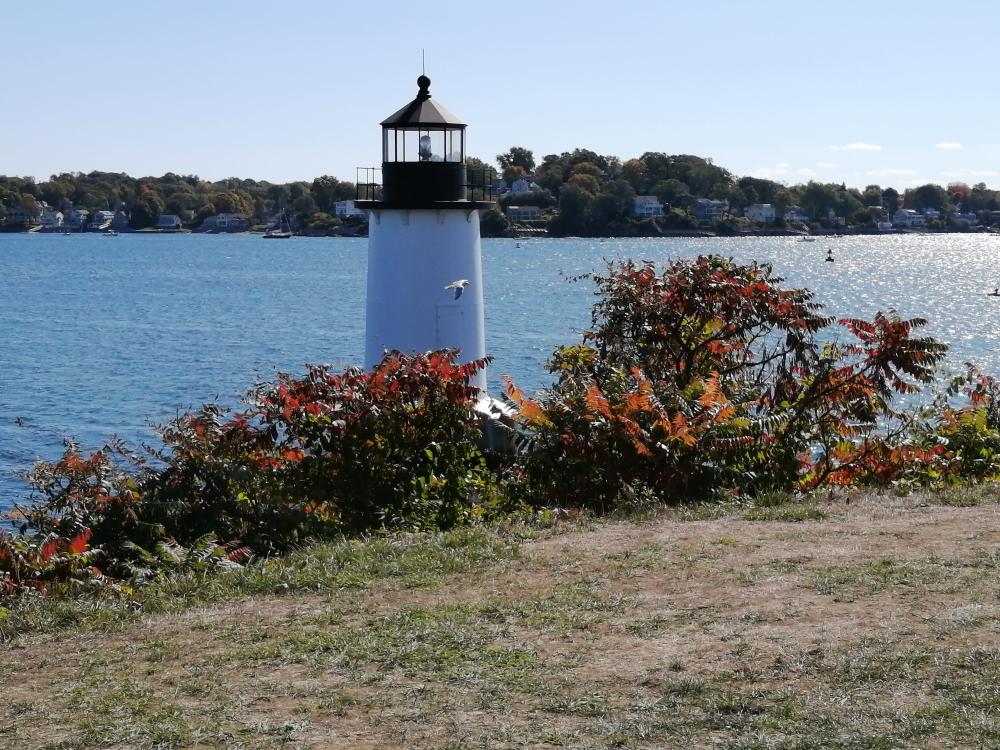
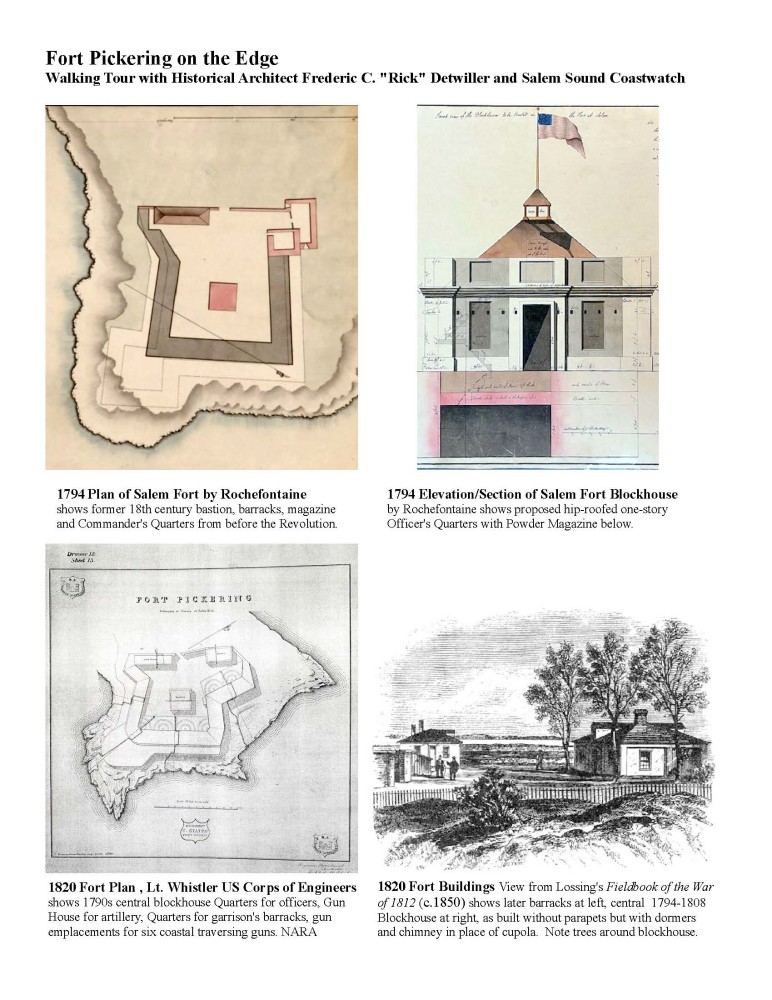
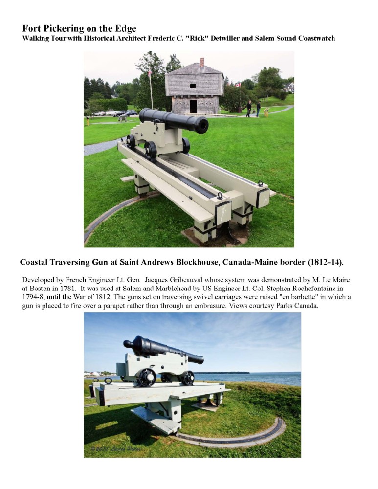
Winter Island Park contains a deep and rich history dating back more than 6,000 years. Throughout the 1620s-1740s, the area was the center of Salem’s fishing trade. The masonry and earthworks of Fort Pickering, Salem’s most historical military base, were established in 1643. In the 1930s, Winter Island became home for the United States Coast Guard and Sea Rescue Station. Today, the park is an important recreational area for nature-lovers, campers, boaters, and beachgoers.
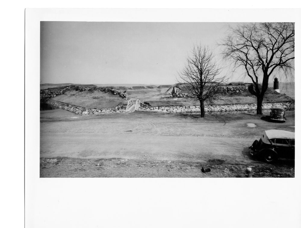
Photo caption: Fort Pickering’s original earthworks circa 1930s. Image courtesy of: Streets of Salem
Protecting Winter Island’s history is an important component of this project. The shallow roots of invasive plants do not help to stabilize the shoreline, but instead, exacerbate erosion. This threatens the coastal banks and the Fort’s earthworks, and our ability to preserve this historic resource.
WINTER ISLAND PARK PATHWAYS
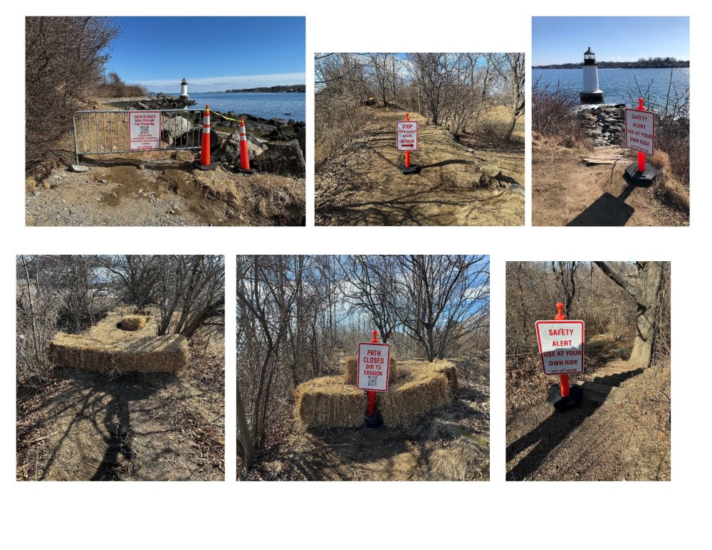
Managing the year-round pedestrian use of the park is a critical first step of this project. Over 4 feet of the pathway up to the lighthouse was lost due to severe winter storms in 2024 (photos to right). Winter Island Park staff closed the trail to prevent further damage to the coastal bank and for public safety.
Do your part to reduce pathway erosion -- please stay on the mapped trails!
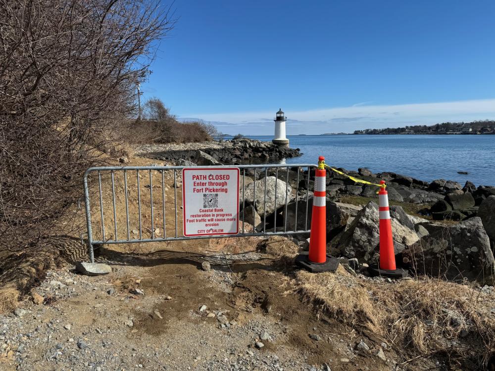
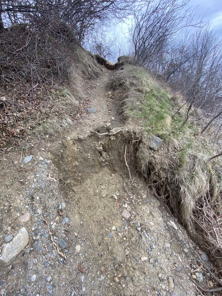
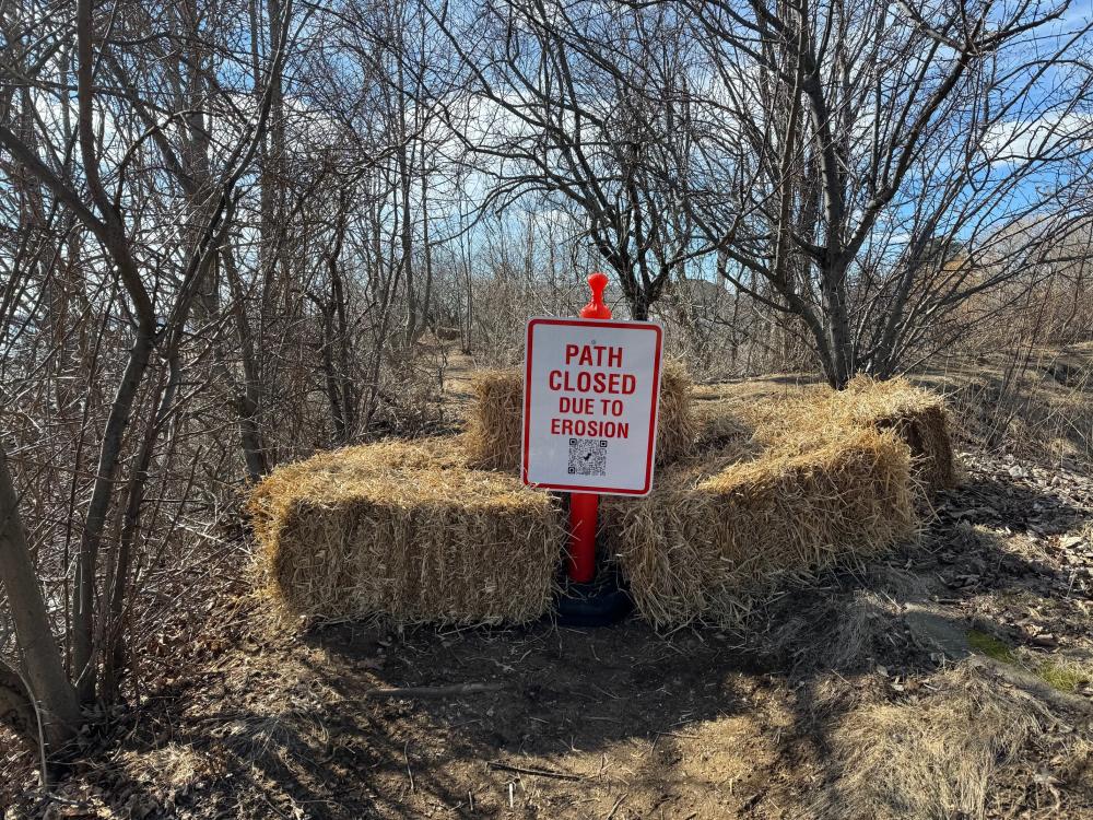
Photo caption: Pathway closed due to severe erosion
THE PROCESS
A topographic and wetland survey have been completed in preparation for ecological restoration. Archaeological and historical assessments will be reviewed to inform the preservation of vulnerable historic assets.
The City of Salem continues to take actionable steps to preserve Winter Island and the park’s public access. You, too, can be part of the solution! Please remember to stay on the designated paths.
FOR MORE INFORMATION
...and to view language translations of this pamphlet, please visit Salem’s Public Input webpage: publicinput.com/d3486

This project is supported by:
The City of Salem, Salem Sound Coastwatch, and MA Office of Coastal Zone Management
View the pamphlet by clicking here.
Fort Pickering's History and Its Future
**Rescheduled**
Tuesday April 23rd @ 4:00pm - 5:30pm
Winter Island Park, 50 Winter Island Rd. Salem
As part of the City of Salem’s Winter Island Park coastal resiliency grant, join Salem Sound Coastwatch’s Barbara Warren and historical architect Rick Detwiller for a tour of Fort Pickering to learn about its history and how invasive species and climate change are impacting the Fort’s earthworks.
Meet at Winter Island Park’s Fort entrance which will be marked with the Salem Sound Coastwatch’s banner.
Fort Pickering Tour Handout
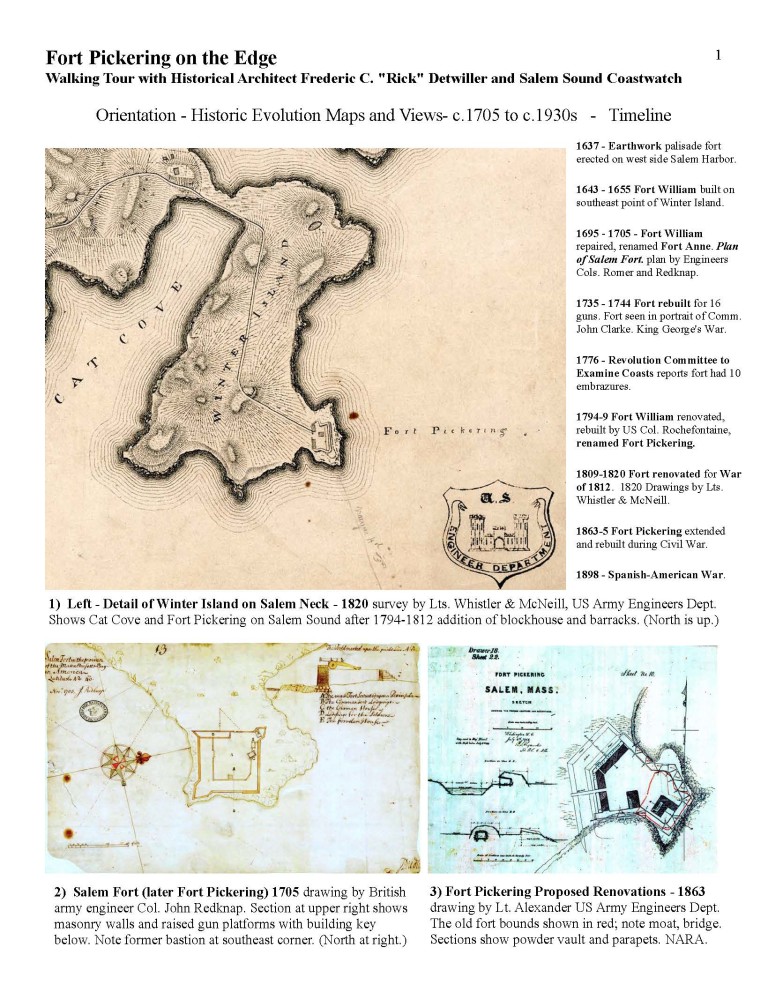
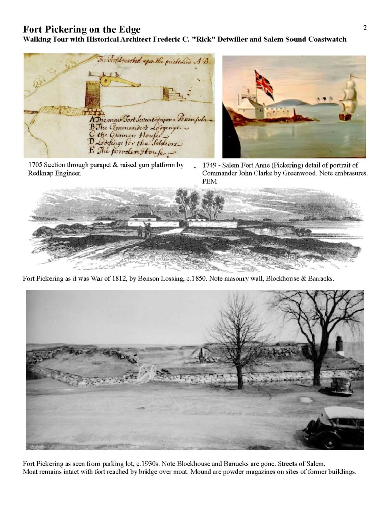
Fort Pickering Tour Supplemental Information
Project Update:
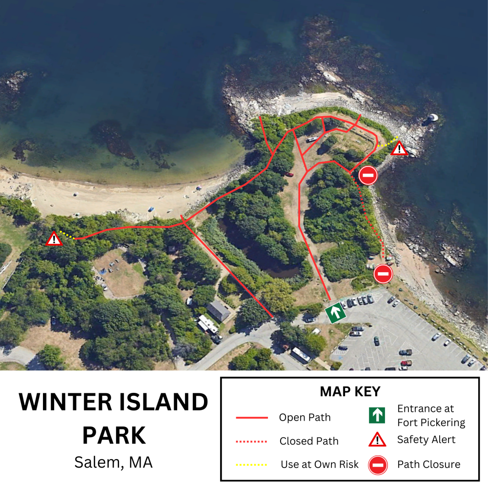
As of 2/22/2024 signage and barriers are now in place. Please see the map on the earlier update for additional information.
Project Update (2/7/2024):
After being hit with 2 winter storms in January a section of the path out at Winter Island washed away. This section is the steep part near the kayak racks as you leave the parking lot and head towards Fort Pickering. Our staff has posted some temporary warnings at the bottom and top of the path. In the next week or so more permanent signage and barriers will be put into place. For park users coming from Waikiki Beach and the light house you will be directed back into the Fort to reach the entrance by the parking lot. Those starting in the parking lot will be directed to enter from Fort Pickering.
The coastal bank and associated wetlands in this area will be surveyed in the next few months as part of this ongoing study. The intent is to use this information for another grant to do the work to improve the coastal bank and the paths. Thank you for your patience.
Frequently Asked Questions
- CZM’s Coastal Resilience Grant Program provides funding and technical assistance for local efforts to evaluate vulnerabilities to climate impacts, increase community awareness and understanding of these issues, plan for changing conditions, redesign vulnerable community facilities and infrastructure, and restore shoreline systems through non-structural approaches.
- Grants may fund feasibility assessments, public outreach, design, permitting, construction, and monitoring of projects that enhance or create natural buffers to erosion and flooding.
- The funding is managed through the Massachusetts Office of Coastal Zone Management.
- The purpose of this study is to assess how the eroding banks and pathways can be best stabilized. This includes better management of the year-round pedestrian use of the park.
- The project supports the Master Plan to “enhance Winter Island’s unique natural resources, preserve its historically significant properties, and increase the public’s access and enjoyment.”
- Once the grant was awarded both the City and the State needed to sign the contract before work could begin.
- Since then, we’ve been working on contracts with Salem Sound Coastwatch - the City’s partner in this grant, and other consultants, such as wetland scientists and surveyors.
- We’ve also held meetings and site walks with the CZM coastal resilience staff and City staff.
- The Pathway and Bank Restoration area includes the coastal bank along the southeast grassy edge of the parking lot, the coastal bank around Fort Pickering over to Waikiki Beach, and the beach’s coastal bank.
- The project ends at the City’s property boundary with Plummer Youth Promise.
- Once the surveyor, wetland scientists, and coastal ecologists are under contract, they will be on the property for several days performing their work. We anticipate that this will occur sometime in February or March depending on the weather.
- The City and Salem Sound Coastwatch will also be out on the property at different times to inform the public about the study and future work.
- You can sign up on this webpage to be notified directly of stakeholder engagement and community outreach events.
- The work for the survey, wetlands delineation, or ecological assessment will not impact public use of the area.
- It is necessary this winter to close a section of the Fort Pickering coastal bank path to prevent damage from further erosion.
- The study will evaluate how paths are used, and other paths may be closed where there are multiple trails to the same area. If this needs to happen, the areas will be clearly marked, and alternative routes will be apparent.
- The information sessions and online material found on this site will highlight any changes.
- This work needs to be completed by the grant deadline of June 30, 2024.
- The team will develop recommendations to manage the erosion, stabilize, and improve the coastal bank and pathways.
- The study’s recommendations will be the basis for a larger (2-year) grant proposal, which will be applied for this spring to design and complete the restoration.
- They are not part of this grant work.
- However, we all know the historical significance of the two structures, and they were identified to be part of the long-term goals in the 2011 Master Plan. That is still the case.
- Seeking funding to restore and/or improve them will continue to be a priority.