SR161 / I-70 Connections Study (Western Licking County)
SR161 / I-70 Connections Study (Western Licking County)
The study area is bounded by SR 161 to the north, I-70 to the south, Licking County boundary to the west, and the Thornwood Drive/State Route 79 (SR 79) corridor to the east. While SR 161 and I-70 are the north and south limits, they are not part of the study.
The purpose of the Connections Study is to
- Plan for improvements that facilitate north-south connectivity between I-70 and SR 161 and identify spot locations where improvements would benefit regional mobility or address safety concerns.
- Develop a range of improvements with stakeholder input that address existing safety issues and future travel demand.
- Develop a plan that identifies and prioritizes transportation investments within the study area that improve north-south connectivity and can be implemented within 5 to 10 years.
Background
Study Background & Purpose
The Ohio Department of Transportation (ODOT) is leading a transportation study to improve north-south connectivity between SR 161 and I-70 in western Licking County. This area is experiencing an increase in population, development, and changes in land use and travel demand resulting from regional investments and general growth in the area.
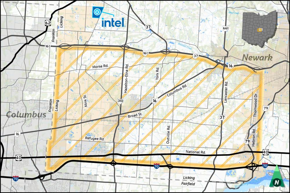
The study area is bounded by SR 161 to the north, I-70 to the south, Licking County boundary to the west, and the Thornwood Drive/State Route 79 (SR 79) corridor to the east as shown in Figure 1. While SR 161 and I-70 are the north and south limits, they are not part of the study
Study Objectives
The primary objective of the study is to identify and prioritize transportation improvements within the study area that improve north-south connectivity between two major east/west highways (I-70 and SR 161) and identify any spot locations within the study area where improvements would benefit regional mobility or address safety concerns and are feasible to implement within a five to ten-year period.
Completion of this corridor study is set for early 2026.