 Falls of Neuse Survey
Falls of Neuse Survey
Thank you for your interest in the Falls of Neuse corridor. The city is working on an update to the existing Falls of Neuse area plan, which includes policy guidance for land use, roadway improvements, and balancing development in an urban watershed area. The plan update is largely focused on land use issues for key parcels in the corridor, but it also will include potential park and transportation improvements as well.
The subject area runs along Falls of Neuse Road from Durant Road in the south to just beyond the Neuse River in the north (see project map below). For more information about the existing plan and plan update process, please see the project page.

The update process has included two public meetings, with a third to take place in August (date/location to be determined). This survey is aimed at supplementing public input gathered during those meetings, particularly a community workshop held on June 21. At that workshop, attendees were asked to consider potential scenarios for several locations along the corridor that are either undeveloped or where redevelopment might reasonably occur in the coming years. Those locations are shown in the Study Sites map below:
The following questions involve exploring the options for various locations contained within the study area. Some locations include multiple scenarios, while others show a single scenario that is plausible given current constraints.

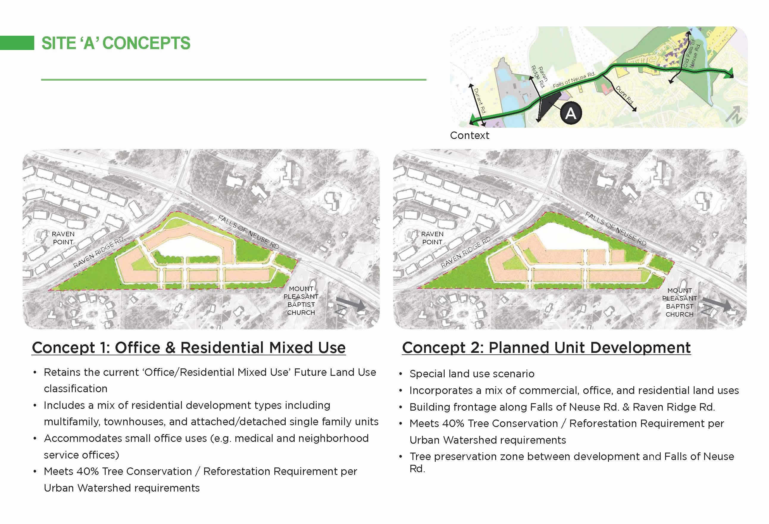
This question pertains to Site A in the Study Sites map, which is the area at the intersection of Falls of Neuse Road and Raven Ridge Road. Two concepts are shown. Concept 1 envisions a mix of office and residential uses. Concept 2 is similar, but adds 10,000 square feet of retail space to the mix.
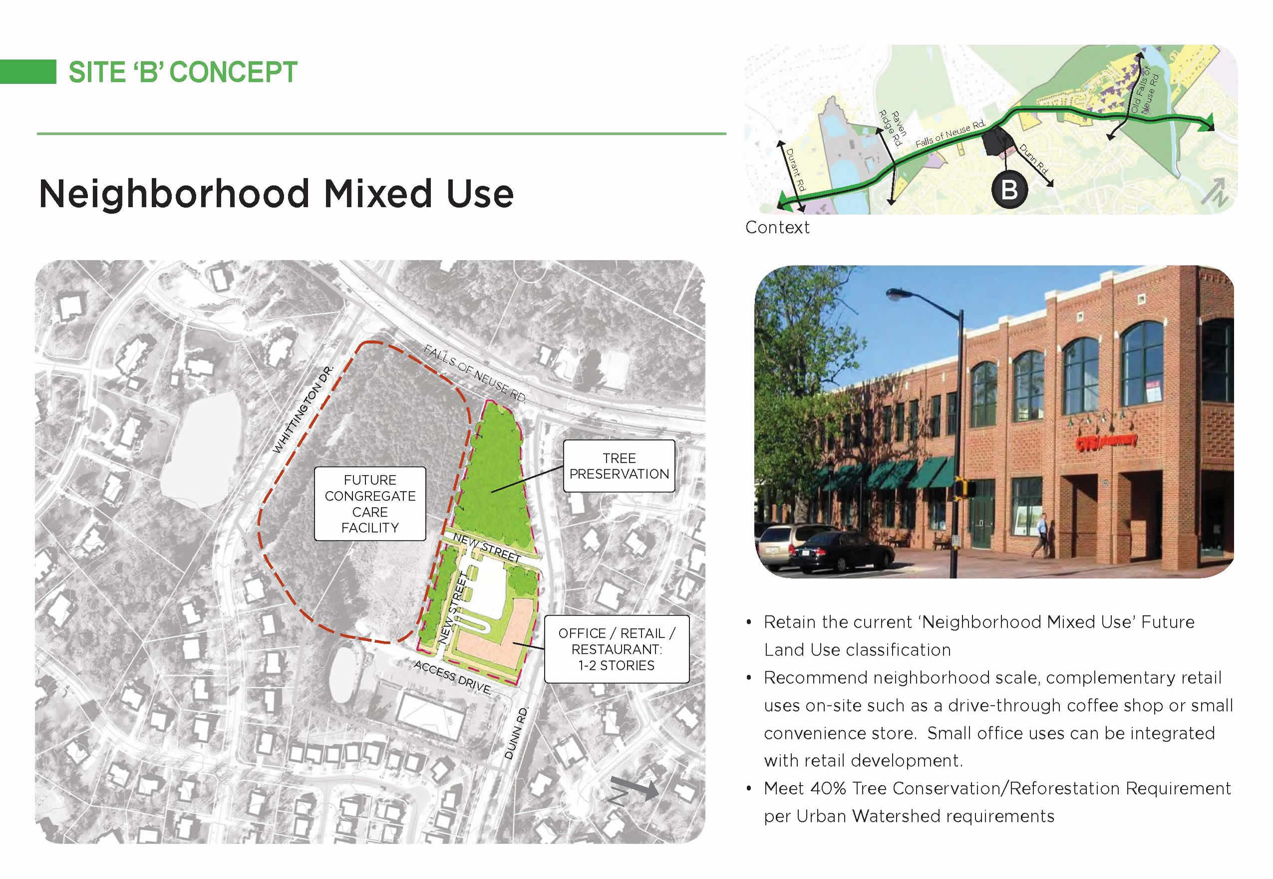
This area is at the intersection of Falls of Neuse and Dunn roads. Most of the undeveloped land here is zoned for a retirement community. Zoning on the remaining land, approximately four acres, allows a limited amount of retail uses and space.
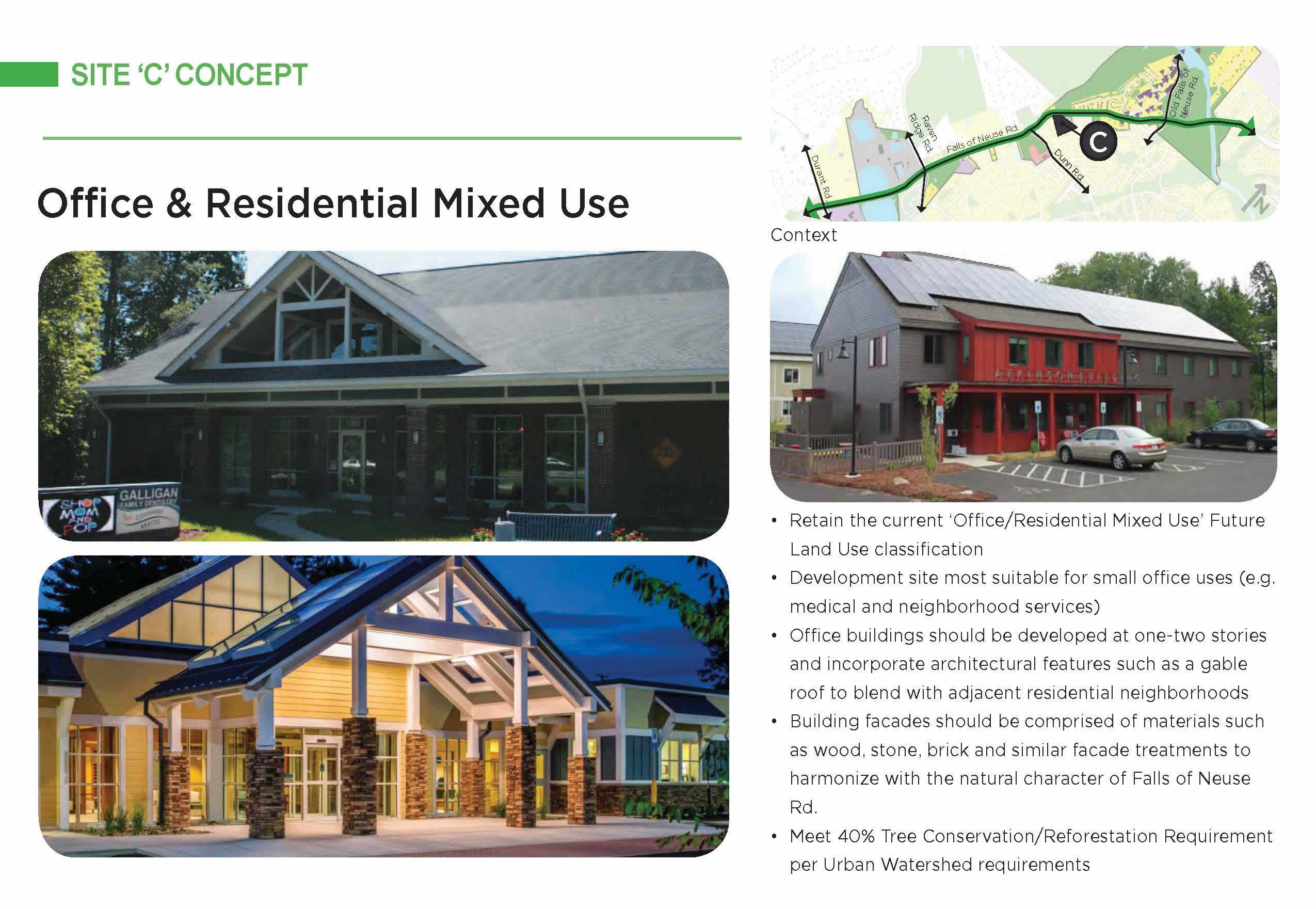
This area includes areas adjacent to the existing dentist’s office on the east side of Falls of Neuse Road, just north of High Holly Lane. The concept shows potential office and residential uses, with office buildings limited to two stories and with architectural features that would be consistent with adjacent residential buildings.
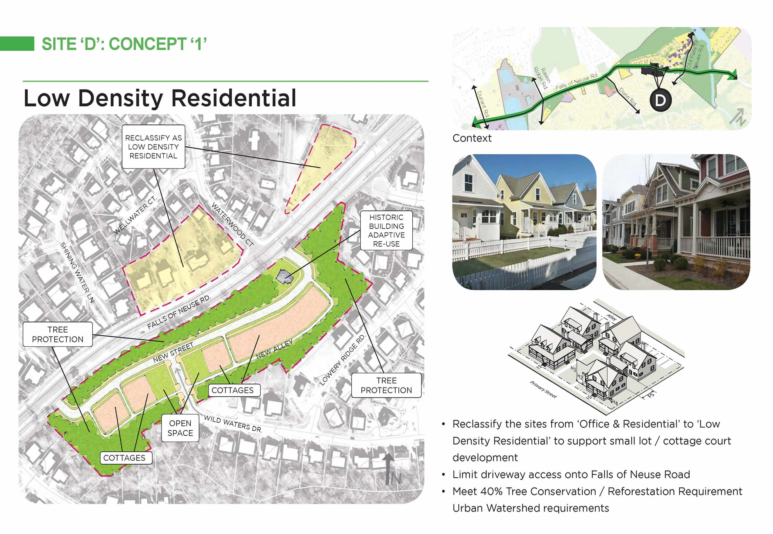
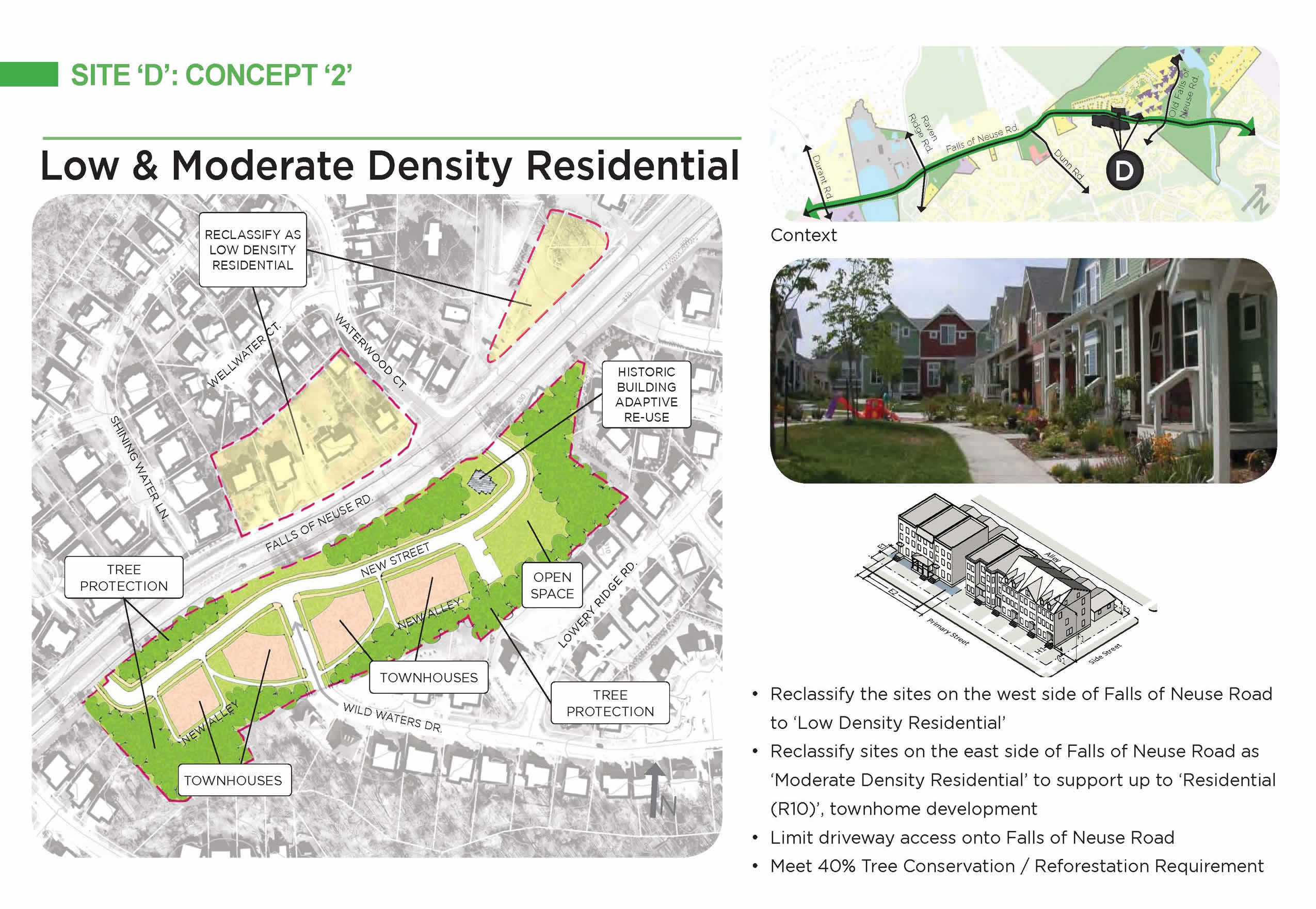
This area includes several larger residential parcels that obtain access directly from Falls of Neuse Road. Existing policy guidance designates the area as suitable for office and residential uses. The two scenarios shown below focus solely on residential uses. The first envisions low-density residential uses, likely detached houses; the second envisions moderate-density residential development, with the possibility of townhouses, though not apartments.
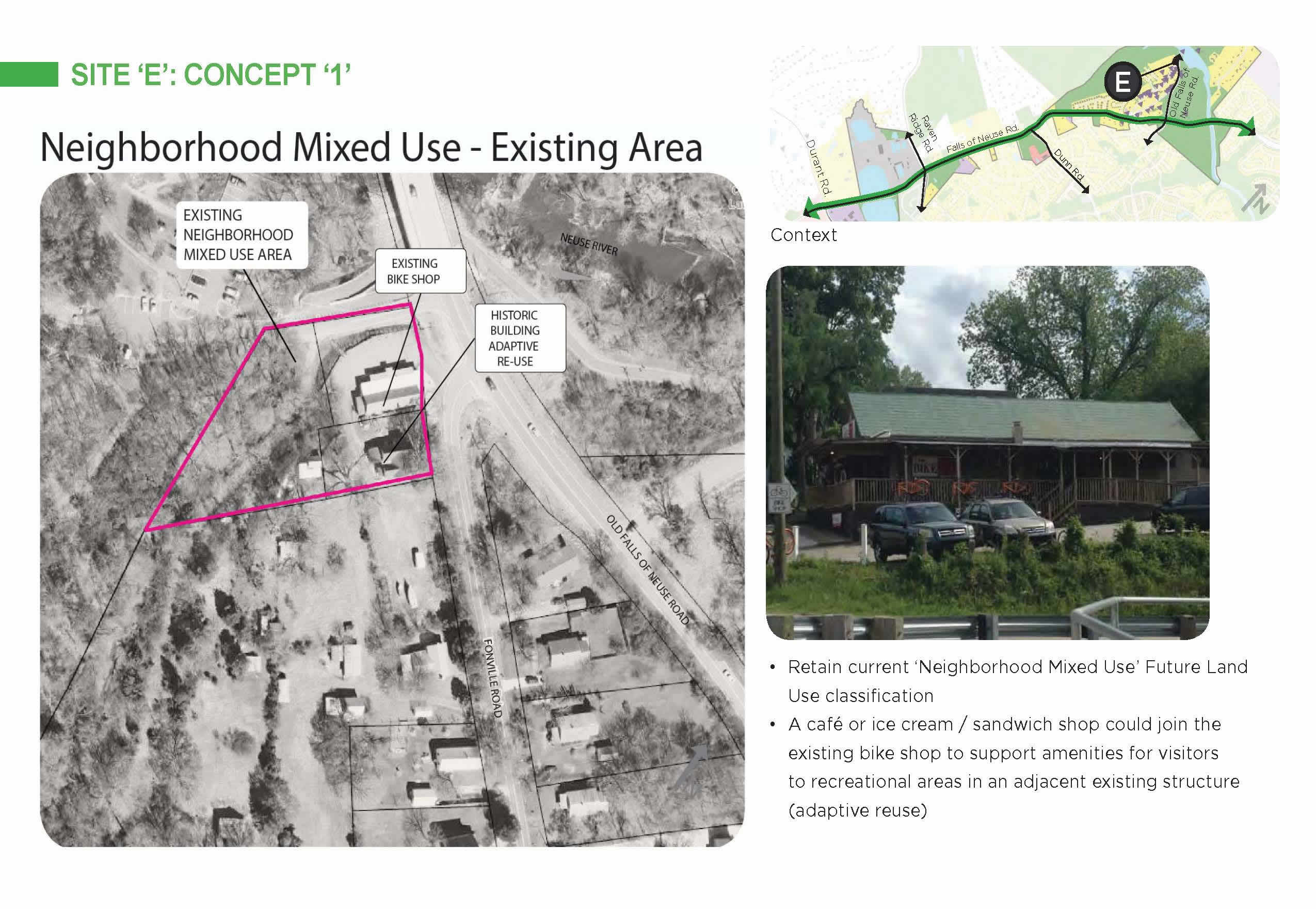
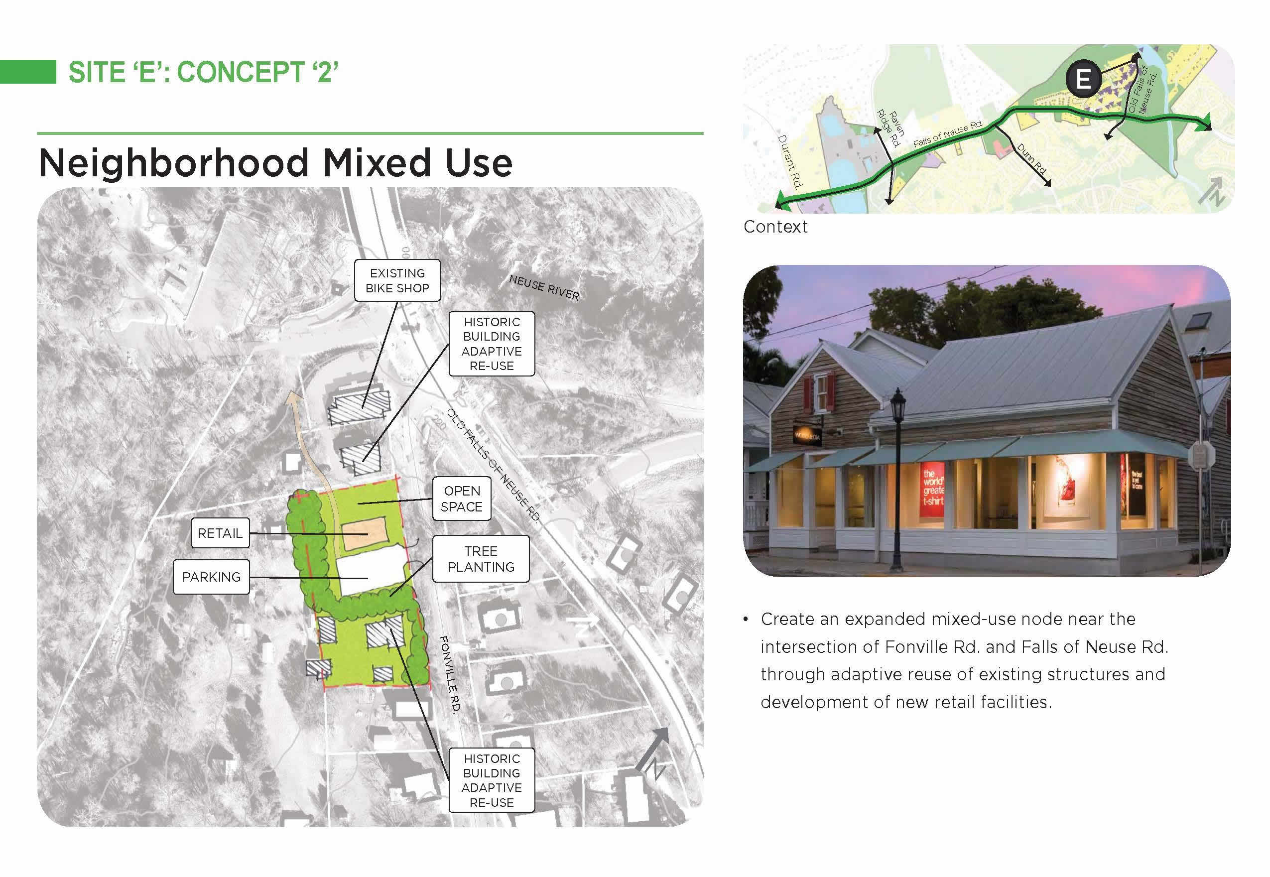
This site involves the small existing commercial area near Falls Lake Dam, at the intersection of Fonville Road and Old Falls of Neuse Road. Both scenarios envision retaining and improving that area. Concept 1 would keep the existing physical boundaries of the commercial area. Concept 2 would add approximately two acres to the commercial area to allow for the potential of a restaurant or other uses that would serve greenway or other recreational users in the area. Concept 2 would include guidance for design so that any new structures would fit into the context of the area.
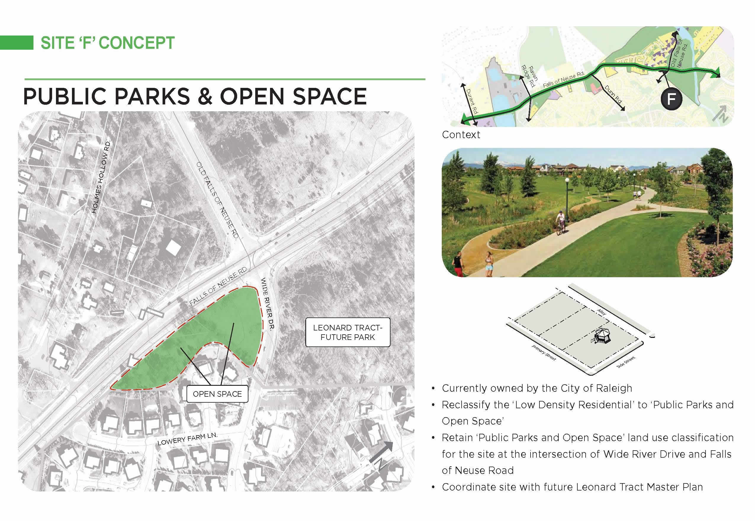
This final site involves city-owned property near the intersection of Falls of Neuse Road and Old Falls of Neuse Road. City property to the north of that intersection (the Leonard Tract, which includes land on both sides of Falls of Neuse Road from Old Falls of Neuse road to the river), is already designated for future park development. This scenario involves designating two additional parcels at the southwest corner of the intersection as Public Parks and Open Space.
Several participants in the plan process have suggested that the identity of this area stems from the large number of natural and recreational resources, including the Neuse River Greenway, Annie Louise Wilkerson, M.D. Nature Reserve, Forest Ridge Park, Falls Lake, and of course the Neuse River itself. Participants have suggested that identity could be strengthened by having a name that reflects the characteristics of the area.