 City of Doraville 2021 Comprehensive Plan Update - Land Use Activity
City of Doraville 2021 Comprehensive Plan Update - Land Use Activity
Future land use is a key part of comprehensive plan. At its core, a land use element maps out and describes what kinds of buildings, development, and character should go where - based on community input and professional staff thought. The land use element then serves as the basis for regulatory tools like zoning.
Please take our brief survey below to offer your input on Doraville's vision for future development, land uses, and community character in different parts of the city.
This activity supplements the more general Plan Update survey conducted between April-June 2021.
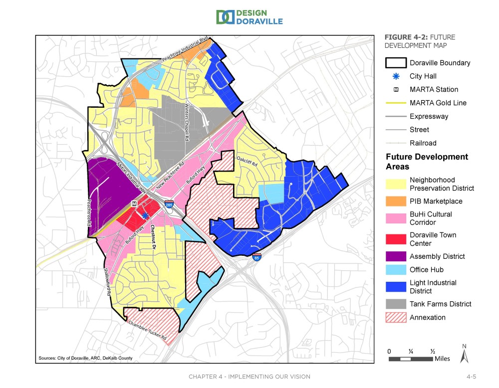
To help orient you, below is a high-level future land use strategy from the City's existing Plan, developed in 2016. Highlights include attracting redevelopment at the Assembly site; promoting redevelopment in the City's Town Center and along Buford Highway; and promoting mixed-use and transit-oriented development (TOD) in appropriate areas such as the Town Center/MARTA Station area and along bus corridors.
Next in the 2016 Plan is the City's Future Development Map, which defines at a high level what types of future development, land use and community character are desired and appropriate in different areas of the city. Shown on the Future Development Map are eight Future Development Areas as well as future Annexation Areas.
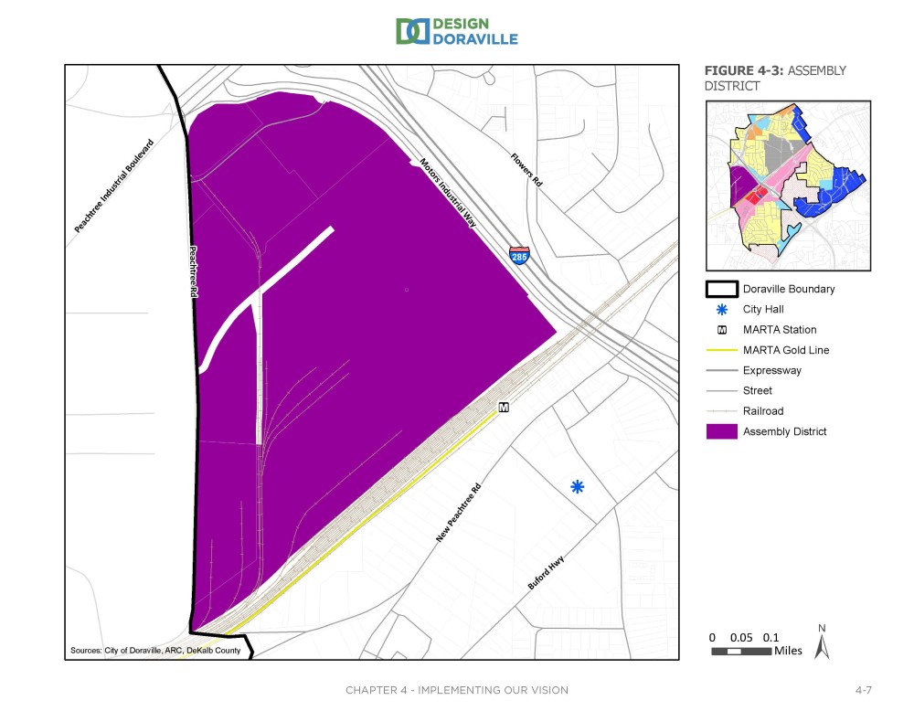
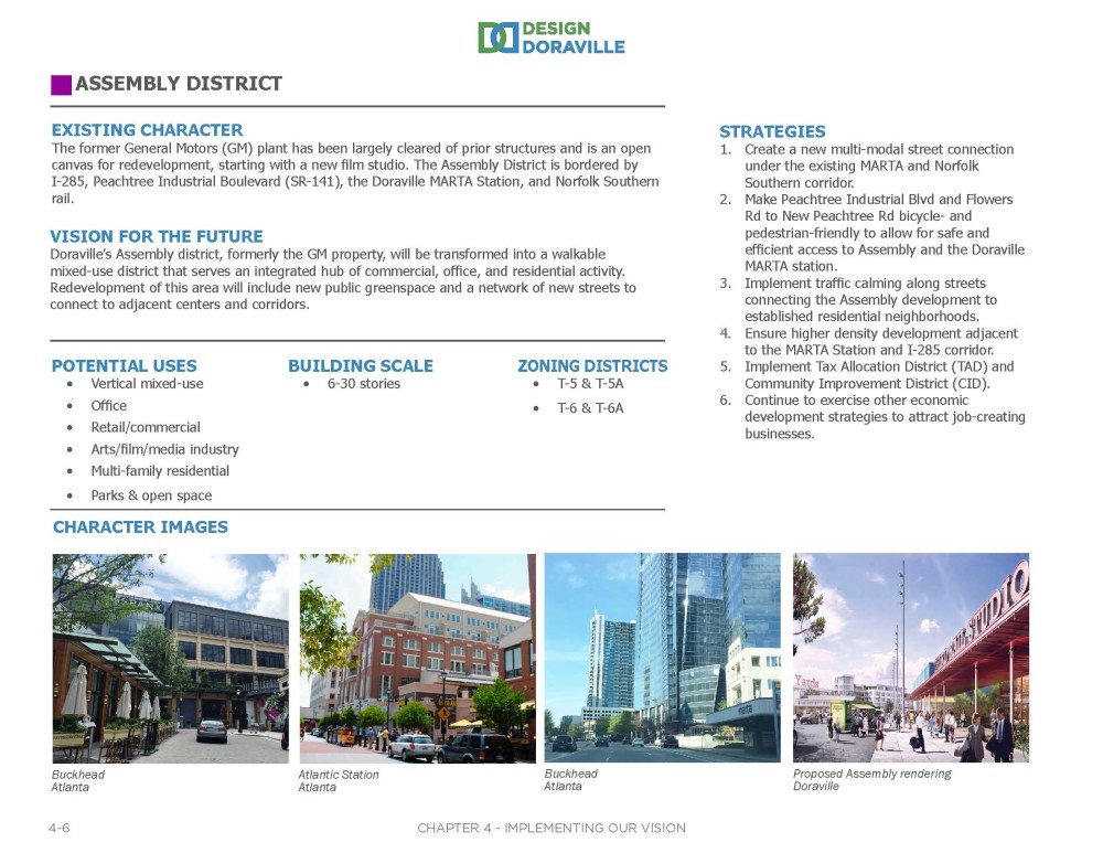
The first Future Development Area described in the Plan is the Assembly District. See below for the district boundaries, followed by information on this area's existing character; future vision; potential development types and building scales; example images; appropriate corresponding zoning districts; and implementation strategies.
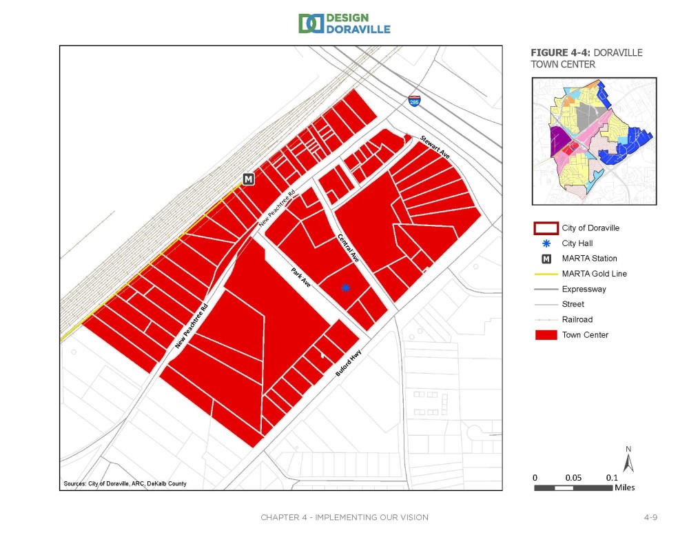
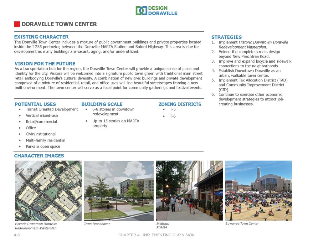
The next area described in the Plan is the Doraville Town Center. See below for the district boundaries, followed by information on this area's existing character; future vision; potential development types and building scales; example images; appropriate corresponding zoning districts; and implementation strategies.
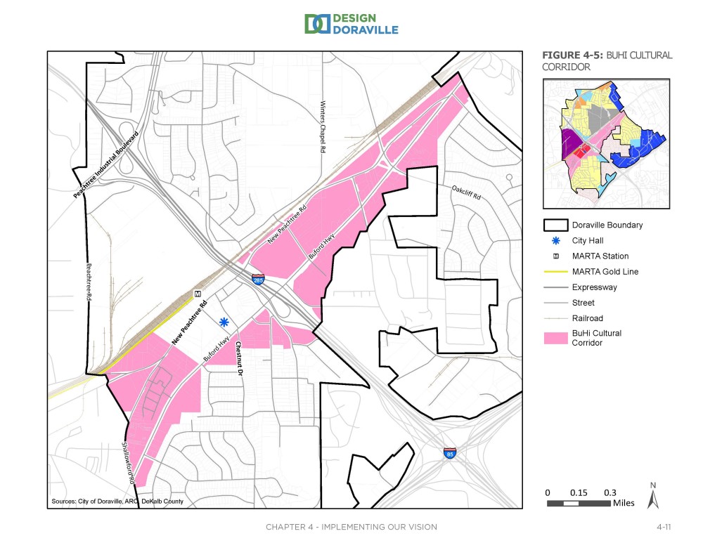
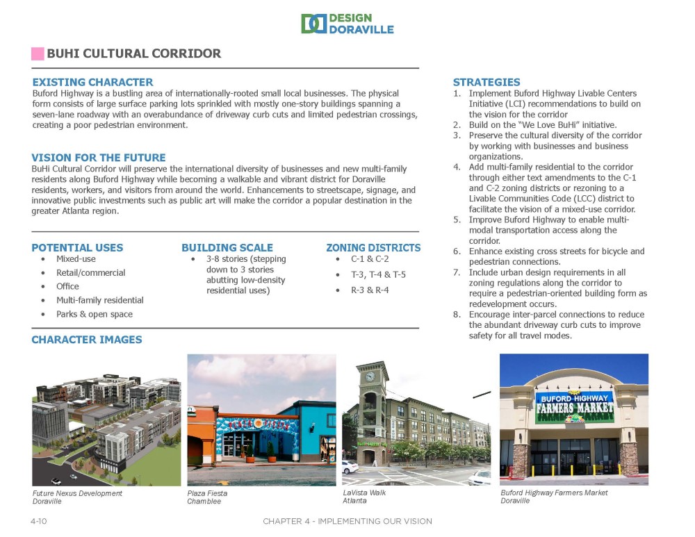
The next area described in the Plan is the BuHi (Buford Highway) Cultural Corridor. See below for the district boundaries, followed by information on this area's existing character; future vision; potential development types and building scales; example images; appropriate corresponding zoning districts; and implementation strategies.
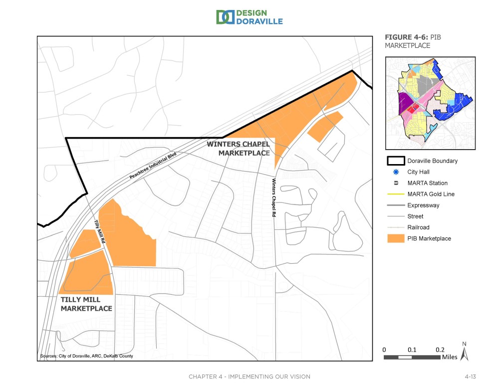
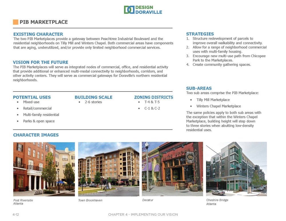
The next area described in the Plan is the PIB (Peachtree Industrial Boulevard) Marketplace. See below for the district boundaries, followed by information on this area's existing character; future vision; potential development types and building scales; example images; appropriate corresponding zoning districts; and implementation strategies.
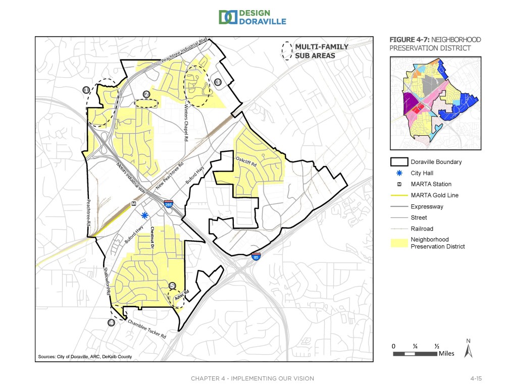
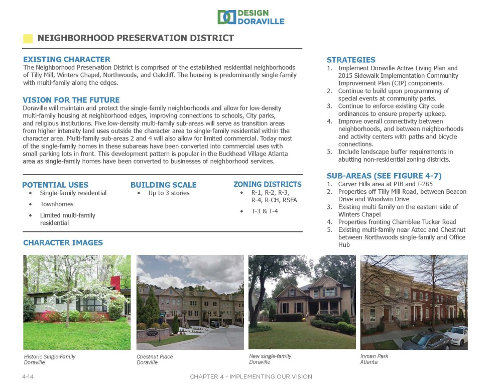
The next area described in the Plan is the Neighborhood Preservation District. See below for the district boundaries, followed by information on this area's existing character; future vision; potential development types and building scales; example images; appropriate corresponding zoning districts; and implementation strategies.
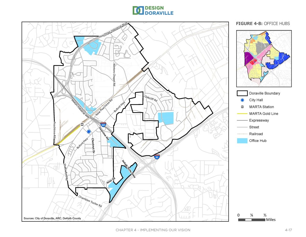
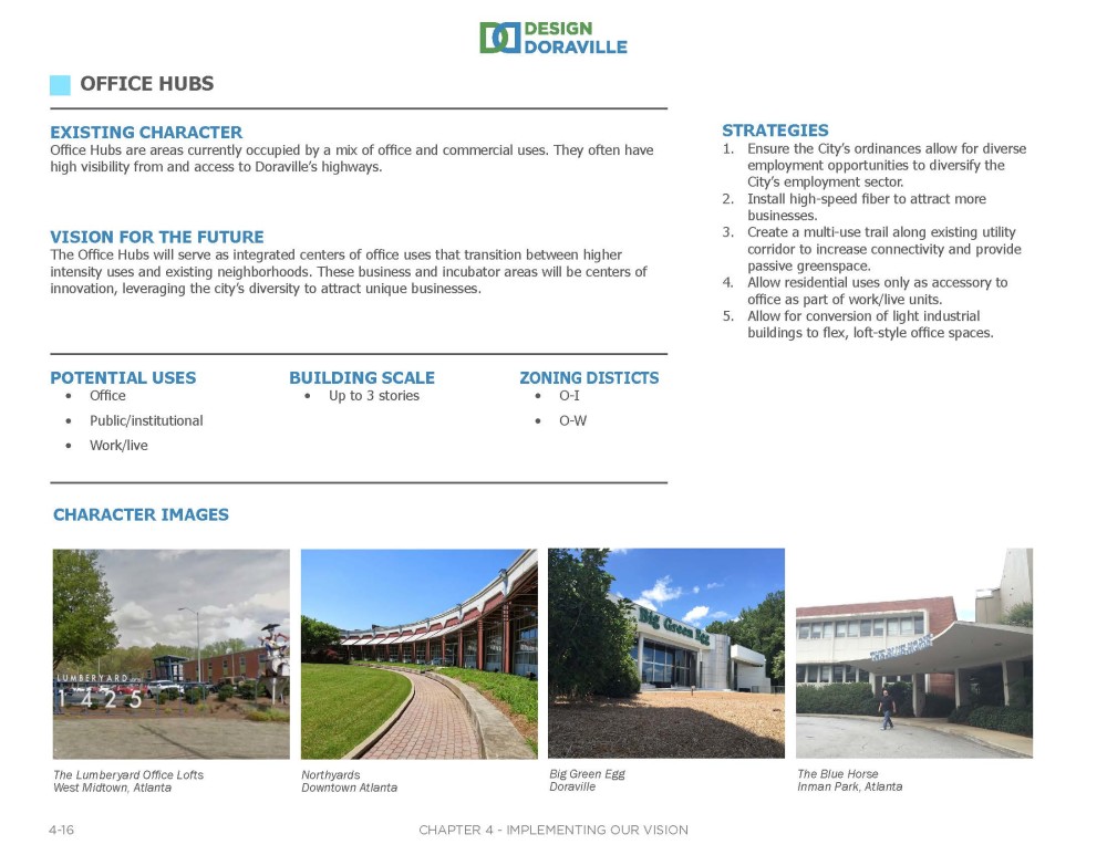
The next area described in the Plan is the Office Hubs area. See below for the district boundaries, followed by information on this area's existing character; future vision; potential development types and building scales; example images; appropriate corresponding zoning districts; and implementation strategies.
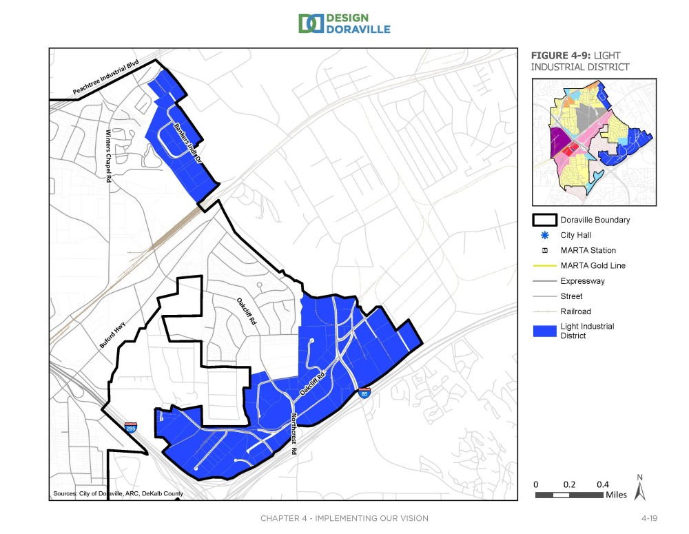
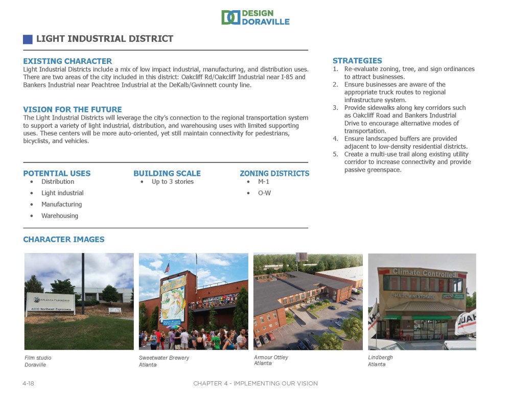
The next area described in the Plan is the Light Industrial District. See below for the district boundaries, followed by information on this area's existing character; future vision; potential development types and building scales; example images; appropriate corresponding zoning districts; and implementation strategies.
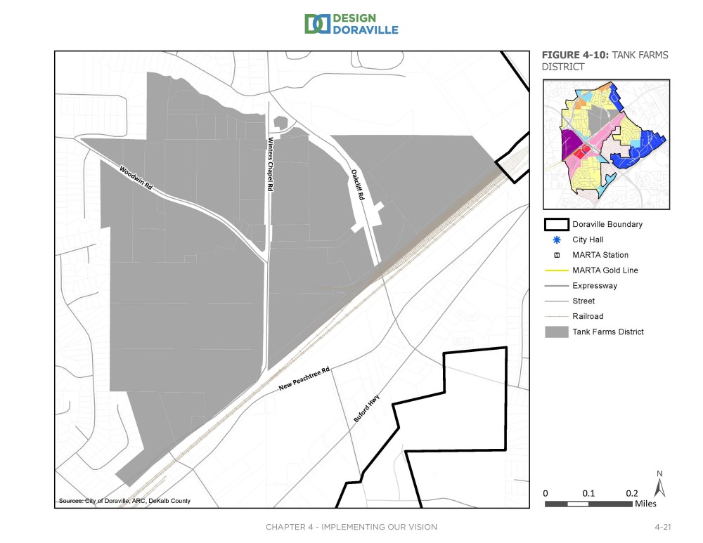
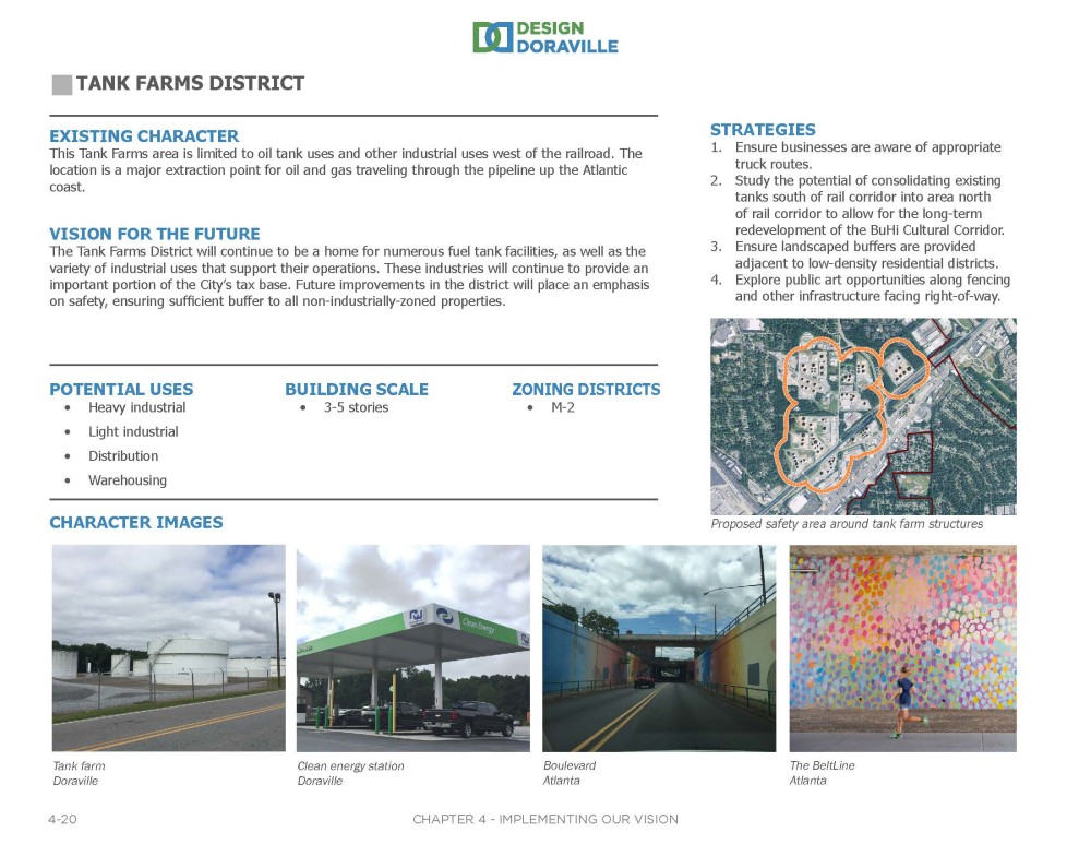
The next area described in the Plan is the Tank Farms District. See below for the district boundaries, followed by information on this area's existing character; future vision; potential development types and building scales; example images; appropriate corresponding zoning districts; and implementation strategies.
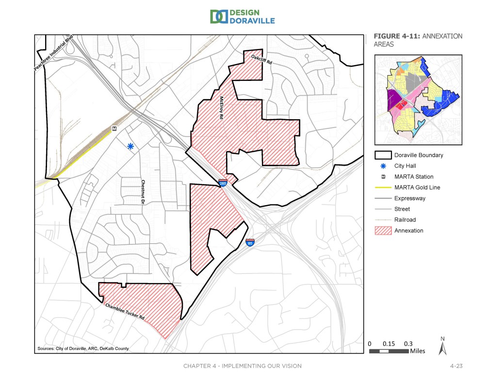
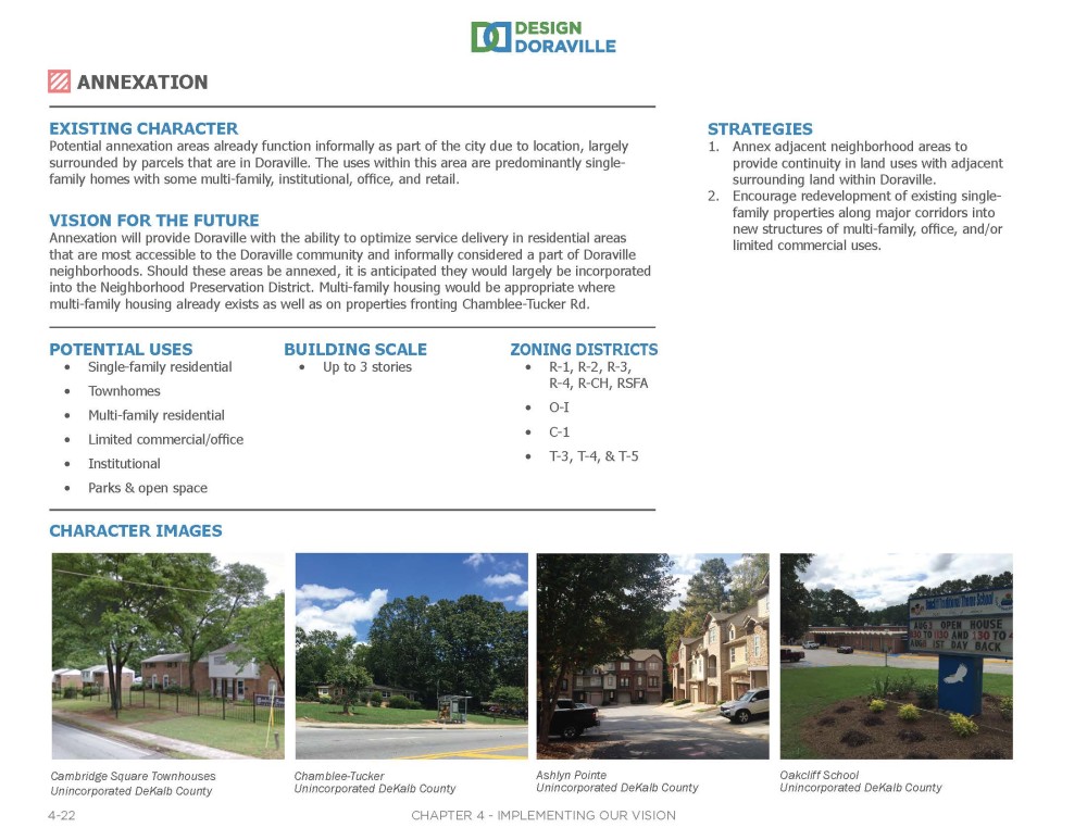
The final areas described in the Plan are Annexation Areas. These are portions of unincorporated DeKalb County that the City is contemplating annexing at some point in the future. See below for the district boundaries, followed by information on this area's existing character; future vision; potential development types and building scales; example images; appropriate corresponding zoning districts; and implementation strategies.