 Waterway Maintenance Planning for Folly Creek, Hungars Creek, Nassawadox Creek, and Red Banks Creek
Waterway Maintenance Planning for Folly Creek, Hungars Creek, Nassawadox Creek, and Red Banks Creek
Accomack and Northampton Counties were awarded $426,500 from the Virginia Port Authority through the Virginia Waterway Maintenance Fund on July 2, 2020 to complete the Folly Creek, Hungars Creek, Nassawadox Creek, and Red Bank projects. The Waterway Maintenance Fund's purpose is to support shallow-draft dredging and beneficial use projects that are not covered by federal funding throughout the Commonwealth. This website will be used as a crucial element in this project to gather information from local stakeholders on potential beneficial use areas along each channel to prevent erosion and stabilize shorelines.
For the project in Spanish, please click here // Para el proyecto en español, haga clic aquí.
For the project in Haitian Creole, please click here // Pou pwojè a an kreyòl ayisyen, tanpri klike isit la.
Website banner image credits: Flickr (1st), Flickr (2nd), Flickr (3rd), Flickr (4th)
Project Locations
How to Navigate this Website
This project website is broken down into several tabs, as indicated above. Please make sure to read through "Project Locations" (below) to get a sense of which four (4) channels are part of this planning effort. Please review "Survey Results" to see the results of the community input survey. Each of the four (4) channels has a designated page, indicated by the tabs above: "Folly Creek", "Hungars Creek", "Nassawadox Creek", and "Red Bank Creek". These 4 project channels provided an interactive map feature to provide site-specific feedback based on the public's familiarity with the site. "Stay Connected" shows the various ways you can be informed. And lastly, be sure to check out "FAQs" for any questions related to this project.
Project Locations
The following information displays the four (4) project locations as part of this effort:
1. Folly Creek – Eastern Shore of Virginia on the Seaside in Accomack County
2. Hungars Creek – Eastern Shore of Virginia on the Bayside of Northampton County
3. Nassawadox Creek – Eastern Shore of Virginia on the Bayside in Northampton County
4. Red Bank Creek – Eastern Shore of Virginia on the Seaside in Northampton County
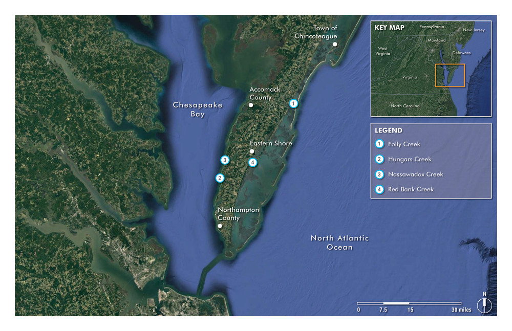
Source: Moffatt & Nichol, 2021
If you haven't already done so, SUBSCRIBE below! We will share information on the upcoming virtual public meetings, survey, as well as the latest project updates.