Zilker Park Vision Plan Community Survey #4: Abridged
Zilker Park Vision Plan Community Survey #4: Abridged
The Zilker Metropolitan Park Vision Plan is a community-driven planning process to establish a guiding framework for the restoration and future development of Zilker Metropolitan Park. It is the first comprehensive planning initiative to encompass the park’s 350 acres and associated facilities. The vision planning process is at a critical milestone in the planning process when the host of ideas that have been contemplated will be presented for the community’s consideration as to where the plan will go.
The survey below follows Community Meeting #3 (watch meeting) and mirrors the Zilker Interactive Map website with the range of alternatives for Zilker Park. We appreciate your time and your review of the information and your feedback.
This survey is divided into 4 sections based on themes for possible park enhancements:
- Zilker Park Priorities by Zone
- Gateways and Visitor Hub
- Ecology and Nature
- Connectivity, Accessibility, and Mobility
This is an abbreviated survey. If you would like to participate in the full survey, please see Survey #4: Zones or Survey #4: Themes, which have the same questions in addition to others.
Zilker Park Priorities by Zone
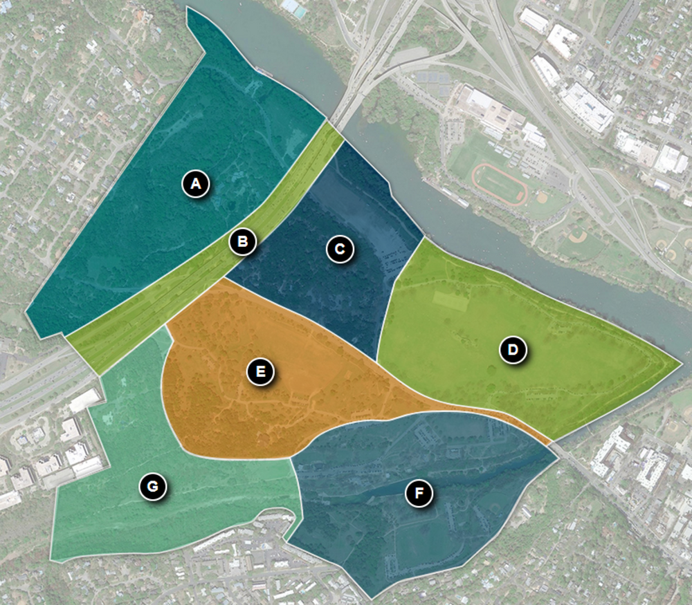
Beginning with questions on desires around each of the zones identified on the Zilker Interactive Map, please identify your overall preferences for each area identified below.
Gateways and Visitor Hub
A visitor hub is a point of orientation for visitors to the park. A hub can contain educational or interpretive displays or be a staging area for recreational or educational programming for youth, seniors, or visitors of all ages. This could be a new structure or buidling or an existing building such as the Zilker Clubhouse, Quonset Hut, Caretakers Cottage, or Girl Scout Hut. The questions below will provide guidance for a possible visitor hub.
Ecology and Nature
Landfill Site: The 17 acres next to the Ann and Roy Butler Hike and Bike Trail and Lady Bird Lake are currently being used as a gravel parking area. The area is also an old landfill that may need mitigation and improvements. Below are three scenarios of what could happen besides leaving it like it is.
- Excavate the entire landfill.
- Maintain the cap to state standards and add soil so that additional plans or programs could be possible.
- Minor improvements, which would limit future options.
Ecological Uplift is the process or enhancing ecological systems where they may not exist, are impaired, or simply can be improved.
For the questions below, please refer to the following definitions:
- Current Maintenance includes contininuing the current levels of mowing (regular, seasonal, no mowing) and ongoing care of trees with active management, which occurs mostly in mowed areas.
- More Mowed Park includes more shade and stormwater management to create a better user experience and increase ecological function in active park areas. Unused mowed areas are ecologically restored.
- Ecological Uplift Plus prioritizes enhancing ecological systems, building further on Ecological Uplift. This scenario expands ecological restoration into some active park areas where those activities can be accommodated in other parts of the park or other parks.

