 Frequent Transit Area Map (CP-15-21)
Frequent Transit Area Map (CP-15-21)
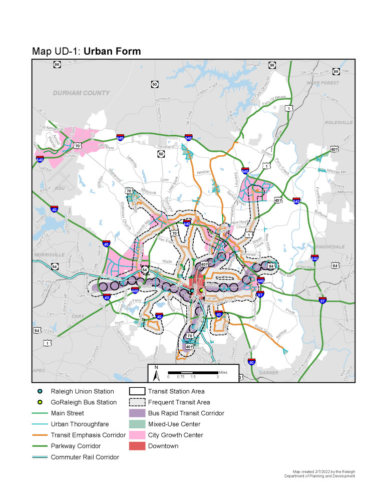
This is a city-initiated amendment to the 2030 Comprehensive Plan to revise Map UD-1 Urban Form Map. The changes involve designating a “Frequent Transit Area” that is within a half-mile of BRT routes and a quarter mile of non-BRT transit routes. Frequent transit is defined as transit with less than 15 minutes between buses or trains during peak hours
The purpose of the change is twofold:
- To provide policy support for regulatory changes that would allow more people to live and to work in areas served by frequent transit.
- To improve walkability in areas served by high levels of transit.
More information is available on the Comprehensive Plan Amendment webpage.
Case planner: Jason Hardin, jason.hardin@raleighnc.gov, 919-996-2657
Proposed Map
(required) What is your full name? (This is required to enter your comments into public record and take them into consideration.)
(required) What is your ZIP code?
Do you have any questions about this change to the Comprehensive Plan? If so, ask in the comment box below. We will be sure to respond to your question here. Please note that your question is public and can be seen by others.
Do you have any comments about this change to the Comprehensive Plan? If so, leave them in the comments box below. Please note that your comments are public, can be seen by others, and will be presented to the Planning Commission.
This is hidden text that lets us know when google translate runs.