 CD Zone Survey
CD Zone Survey
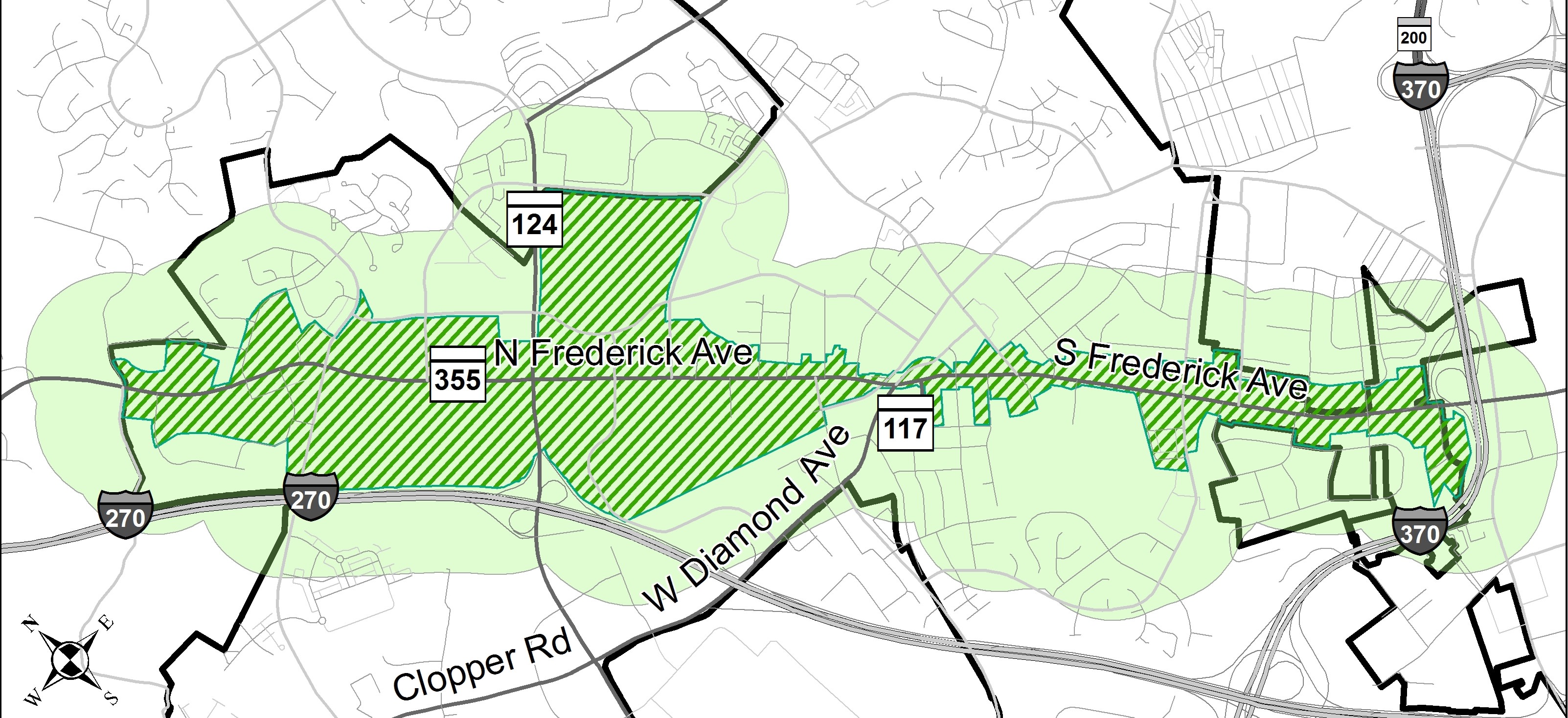
The Corridor Development (CD) Zone was created in conjunction with and to implement the Frederick Avenue Corridor Land Use Plan, adopted in 2001. The plan envisioned all of the Corridor being zoned CD, to encourage a mix of housing, restaurants, stores and offices that would revitalize the Corridor. The CD Zone itself does not make specific land use recommendations for individual properties, such as where a grocery store should be located. The CD Zone does establish the standards that must be met and the processes that must be followed in order to build something like a grocery store. The City of Gaithersburg is now seeking public input on whether or not the CD Zone, after seventeen years, needs to be revised. The following survey and its results will help staff, the City Council, and the Planning Commission determine how, if at all, the CD Zone should be changed in order to better serve development in the Corridor, highlighted in green below. A separate project page with more information about this effort may be found here: http://www.gaithersburgmd.gov/government/city-projects/cd-zone. Comments and questions may be sent to cdzone@gaithersburgmd.gov.

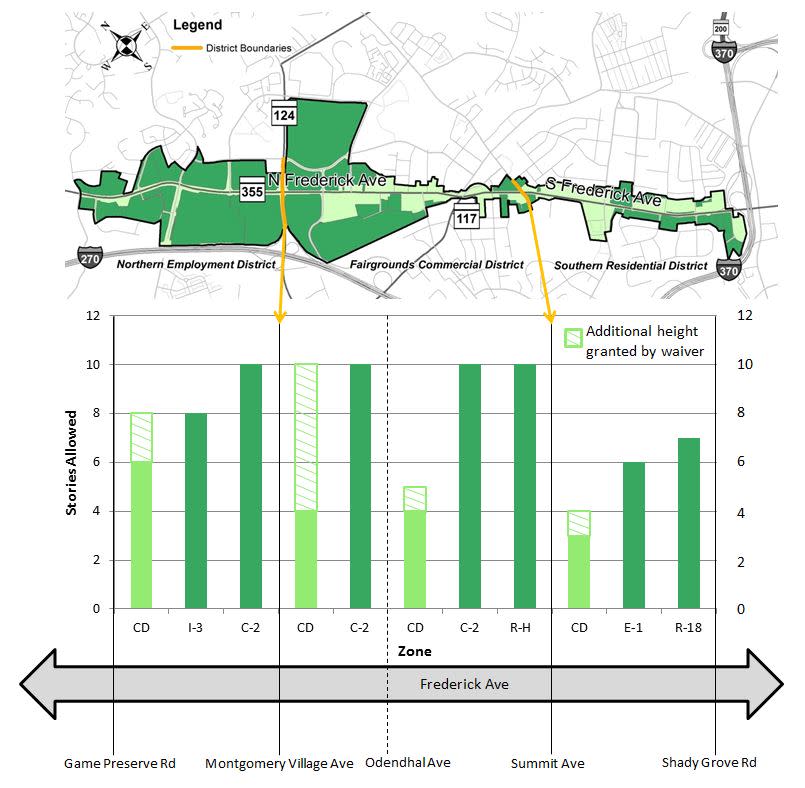
The CD Zone divides the Frederick Avenue Corridor into three districts with differing height restrictions. However, within these districts are properties zoned other than CD that allow greater height. The non-CD properties are highlighted in dark green on the map and the allowable heights are illustrated in the graph below.
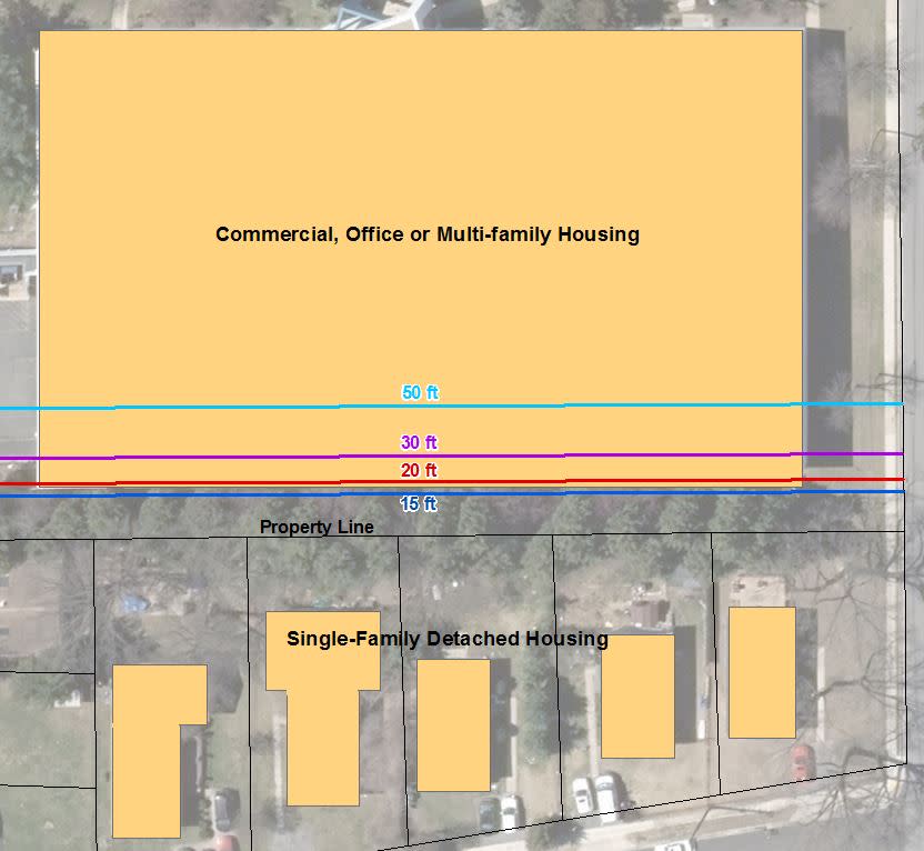
A setback is a zoning tool that requires buildings to be a certain distance away from property lines. The graphic below illustrates four different rear setback distances (15 feet, 20 feet, 30 feet, and 50 feet) on a property that backs onto single- family detached houses.
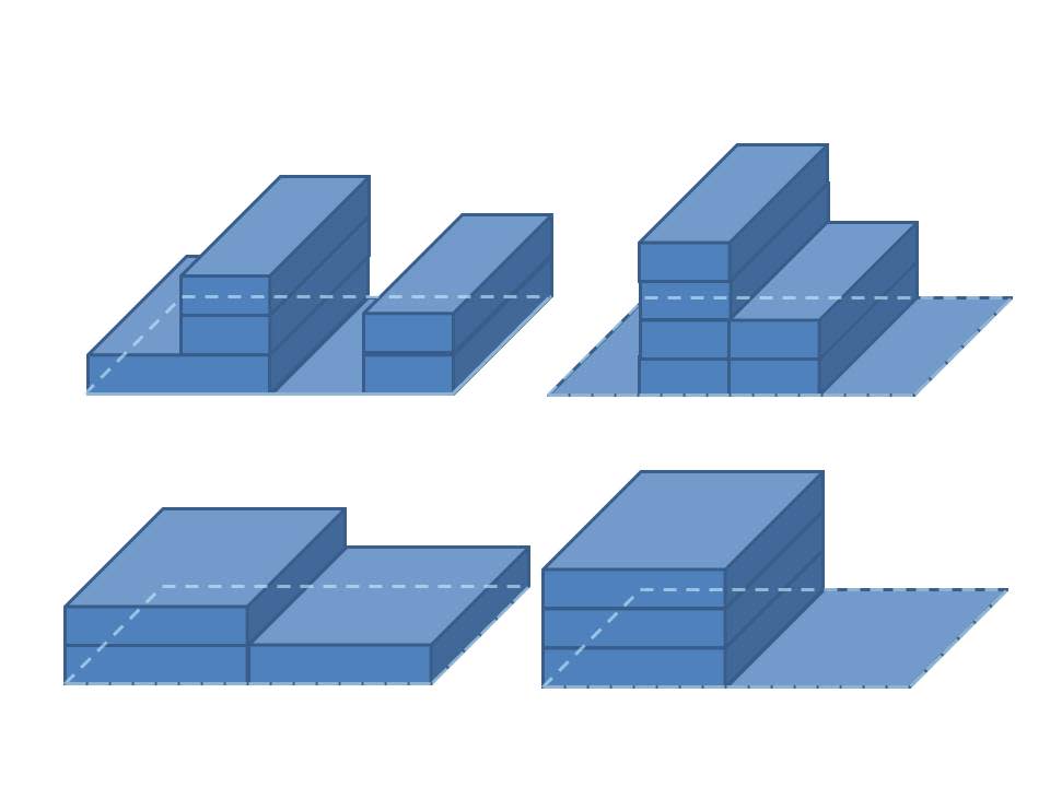
Floor area ratio (FAR) is the ratio of building size (total square feet) to lot size. It is sometimes used as an alternative to other building size controls (like height and setback requirements) as it affords greater flexibility in design. FAR also allows property owners to easily calculate how much development they may build. The images below each illustrate a 1.5 FAR. On a 100 square foot lot, you could build 150 square feet (1.5 x 100). As shown below, the building(s) can take many different forms as long as the FAR does not exceed 1.5.