 State Route 68 Scenic Corridor
State Route 68 Scenic Corridor
.
Overview
Project Setting
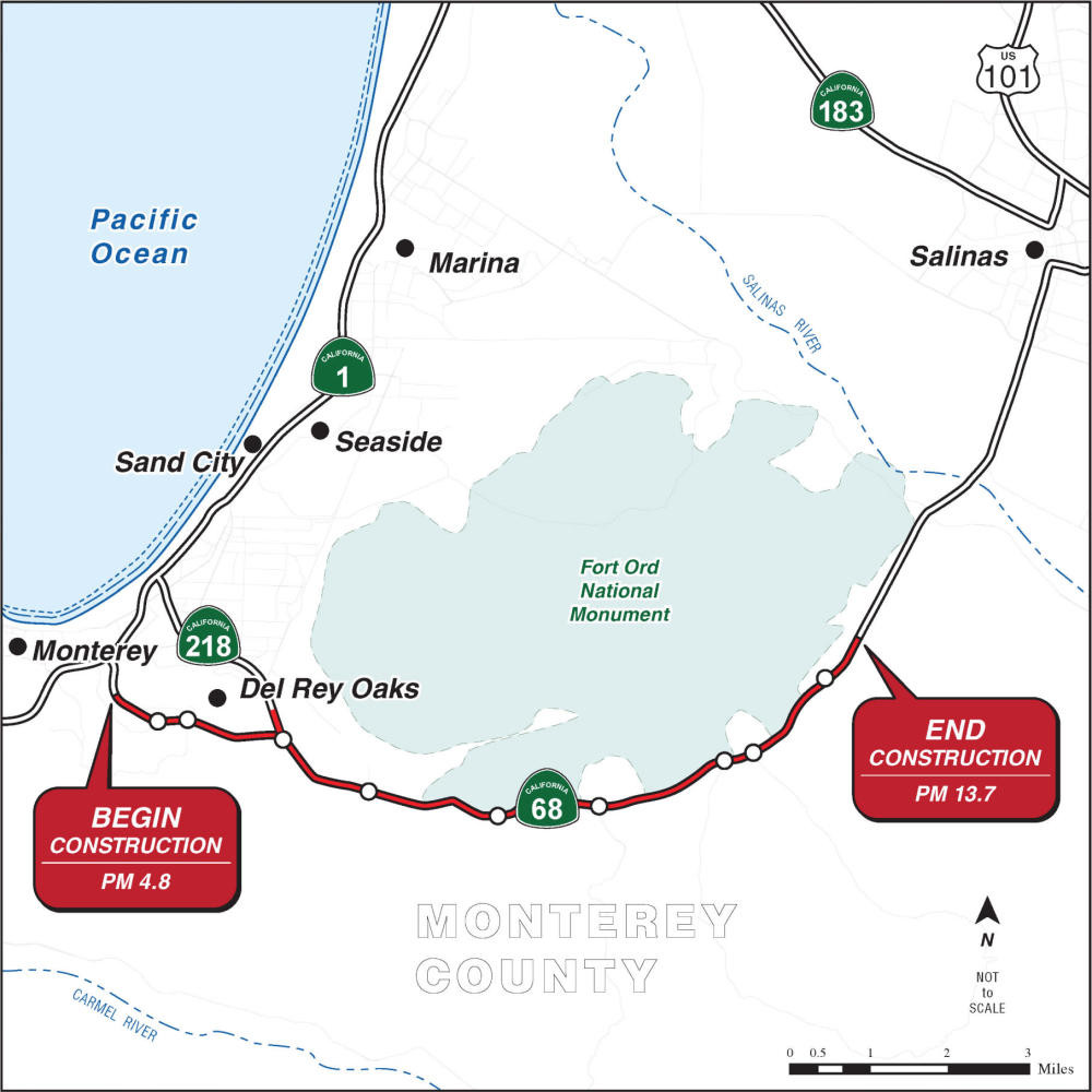
The State Route 68 scenic corridor is a primary gateway to the Monterey Bay Peninsula. It serves the area known as "Steinbeck County" linking historic Cannery Row to the agricultural fields of the Salinas Valley. Over 26,000 vehicles currently use this route each day to access work, schools, doctor appointments, and tourist destinations. It is a gateway to the Laguna Seca Recreation Area, home to the renowned WeatherTech raceway which is considered one of the top 10 motorsports destinations in the world. State Route 68 provides direct access to the Monterey Regional Airport that serves over 500,000 passengers each year. This corridor is situated in an environmentally sensitive area and must maintain natural wildlife crossings that link the Fort Ord National Monument located to the north and Los Padres National Forrest to the south of the state highway facility. In 1968 State Route 68 was one of the first facilities to be designated a scenic highway that “require special conservation treatment.” This corridor project will provide for our regional mobility needs while preserving this environmentally sensitive setting.
Project Description
The goal of the Scenic Highway 68 Corridor Improvement Project is to address safety concerns for motorists and improve traffic flow between Monterey and Salinas. The project will be designed to provide new wildlife connections under the highway. The environmentally sensitive setting required this project to meet these objectives without adding new lanes on the roadway mainline. After a thorough environmental evaluation, the California Department of Transportation (Caltrans) is proposing to construct a project to convert all nine signalized intersections into roundabouts. The first project phase was selected to install roundabouts at the intersections of San Benancio Road, Corral de Tierra and Laureles Grade.
Adaptive Traffic Signal Controls
The TAMC Board asked staff to identify options to best utilize the existing signalized infrastructure before committing to the relatively high cost associated with roundabouts. The Agency subsequently funded an Adaptive Traffic Signal Control (ATSC) project covering nine signals on the SR 68 corridor. This project has been described as implementing Artificial Intelligence (AI) technology to monitor real time traffic data and rapidly adjust signal operations to best serve traffic. Using the ATSC project as a baseline, TAMC staff will hire a third-party consultant to evaluate the benefits and impacts of Adaptive Traffic Signal Controls on SR 68 traffic. The ATSC project will be used as a baseline when making future decisions about proceeding with constructing roundabouts on the SR 68 corridor.
The TAMC Board authorized $1.2 million for Caltrans to conduct a five-year adaptive signal pilot project on State Route 68, which includes nine signalized intersections that experience significant congestion during peak commute periods. With funding from the Transportation Agency, Caltrans procured a system from Miovision designed to improve traffic flow using real-time traffic data and technology incorporating artificial intelligence (AI) in 2025. Unlike traditional signal timing, this adaptive system continuously adjusts to changing traffic conditions, allowing it to optimize traffic flow and respond to seasonal traffic fluctuations, special events, and incidents. The system is being evaluated as a five-year pilot program intended to provide real-world performance data while the Agency evaluates whether the benefits of roundabouts justify their cost relative to the adaptive signal system.
The Miovision adaptive operations systems were implemented on May 5, 2026. A preliminary analysis was done on the adaptive operations to reflect typical conditions when local schools are in session. Early results show improved travel times in the prime direction of traffic flow during peak commute times. Caltrans will provide another presentation on the effectiveness of the AI system and the next steps of the project to the TAMC Board of Directors on June 27, 2026.