Lakeville Corridor Strategic Plan - Existing Conditions and Needs Phase I
Lakeville Corridor Strategic Plan - Existing Conditions and Needs Phase I
The Lakeville Corridor Strategic Plan was started in late 2022. This project will result in a strategic plan that identifies access management improvements to businesses and properties, mitigation of stormwater impacts, and active transportation (bicycle and pedestrian) improvements for the Route 20A (Big Tree Road) corridor from West Lake Road to East Lake Road in the Town of Livonia, Livingston County.
The project is being overseen by a steering commitee of local residents, business and property owners, and town, county, and state officials. The planning process includes data collection and analysis of current conditions, a needs assessment and community visioning process, and recommendations for future action. A consultant team is handling the technical work of developing the project.
The steering committee is committed to providing community members with ample opportunities to engage in the planning process and provide feedback on important questions and decisions regarding the future development of the corridor.
Community Survey
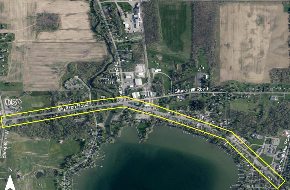
The image below provides an aerial view of the Lakeville Corridor Strategic Plan project area. The yellow outline shows the project area, where improvements to transportation and stormwater infrastructure will be made.
Please complete the following community survey questions. Your responses will be used by the project steering committee to identify improvements to the project area.