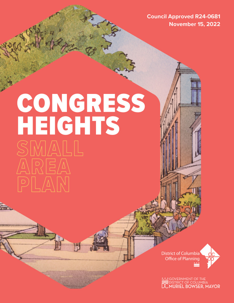
Congress Heights Small Area Plan
Congress Heights Small Area Plan
We are planning. We are planning together. We are planning for equity.
Events
Home
Congress Heights Small Area Plan Health Equity Impact Report
During the CHSAP process, DC Health’s Office of Health Equity (OHE) collaborated with OP to develop a Health Equity Impact Report (HEIR) pilot. The HEIR is as a companion document to the CHSAP and is a component of plan development and implementation. Its purpose is to:
- Evaluate the potential health outcomes of proposed projects on individuals and communities;
- Identify opportunities to reduce negative or disparate health effects;
- Support healthy communities, healthy community design, and development; and
- Inform decision makers about the potential health impacts of proposed policies, programs, or projects
Download the full report here!
Congress Heights SAP Approved by Council!
The DC Office of Planning (OP) is pleased to share the Congress Heights Small Area Plan was approved by Council on November 15, 2022.
DOWNLOAD THE APPROVED PLAN HERE.
Thank you for your involvement in this planning process! The Small Area Plan guides government, private sector, and community stakeholder efforts to bring diverse housing, inclusive economic development, vibrant and safe streets, and responsive community resources, and amenties to the Congress Heights Area.
We are planning and kicking off an equitable development plan for Congress Heights and adjacent neighborhoods in Southeast, DC.
We are planning together with you to establish a vision for the future of Congress Heights. We want to hear from you every step of the way. Interested in planning with us? Sign up to get involved with the project below. You can always find project updates and get in touch with us through this website.
We are planning for equity and reflecting the Mayor’s Proposed Comprehensive Plan focus on racial and socio-economic equity, outline the community’s vision for the future of Congress Heights, serve as a toolkit for Congress Heights stakeholders to lead conversations around equitable community development, and guide District implementing agencies and developers on community needs and priorities. We aim to document a shared community vision for Congress Heights and integrate ongoing community work.
The Congress Heights Small Area Plan is led by the Office of Planning (OP). The plan is managed by:
- Valecia Wilson, Ward 7 and 8 Planner, Project Manager
Questions? Reach out to us online at CongressHeightsPlan@dc.gov or on the phone at 855-925-2801 (pin: 9965). We looking forward to hearing from you.

About the Project
The Congress Heights Small Area Plan (CHSAP) will study: social equity and community resilience; historic and cultural preservation; real estate and business opportunities; schools, libraries and public space; transportation and access; housing opportunities and affordability; and parks, streets, and public space.
The 2020 public health emergency and resulting economic crisis have altered many aspects of daily life. We are facing new and unique challenges in our communities. As a result, we want to take this moment to respond to the current needs of our community and plan for a more equitable, prosperous, healthy, and safe future for all. Let's get planning!
Contact Us:
Valecia Wilson, Ward 8 Planner, Project Manager
Email: CongressHeightsPlan@dc.gov
Phone: 855-925-2801 (pin: 9965).
We looking forward to hearing from you!
Frequently Asked Questions
Small Area Plans (SAPs) supplement the Comprehensive Plan by providing more detailed recommendations and implementation strategies for the development of city blocks, corridors, and neighborhoods. The intent of such plans is to guide long-range planning and development that establishes future neighborhood improvements, identifies gaps and opportunities in neighborhood services and amenities, and advances social and economic benefits.
SAPs are developed through a collaborative process that entails significant community outreach and engagement, to both communicate the goals and milestones of the planning process as well as provide opportunities for community dialogue on strategic priorities in the planning area. SAPs are typically approved by resolution of the DC Council, and their key recommendations are subsequently incorporated into the Comprehensive Plan Elements.
Learn more about SAPs at planning.dc.gov/page/op-neighborhood-planning.
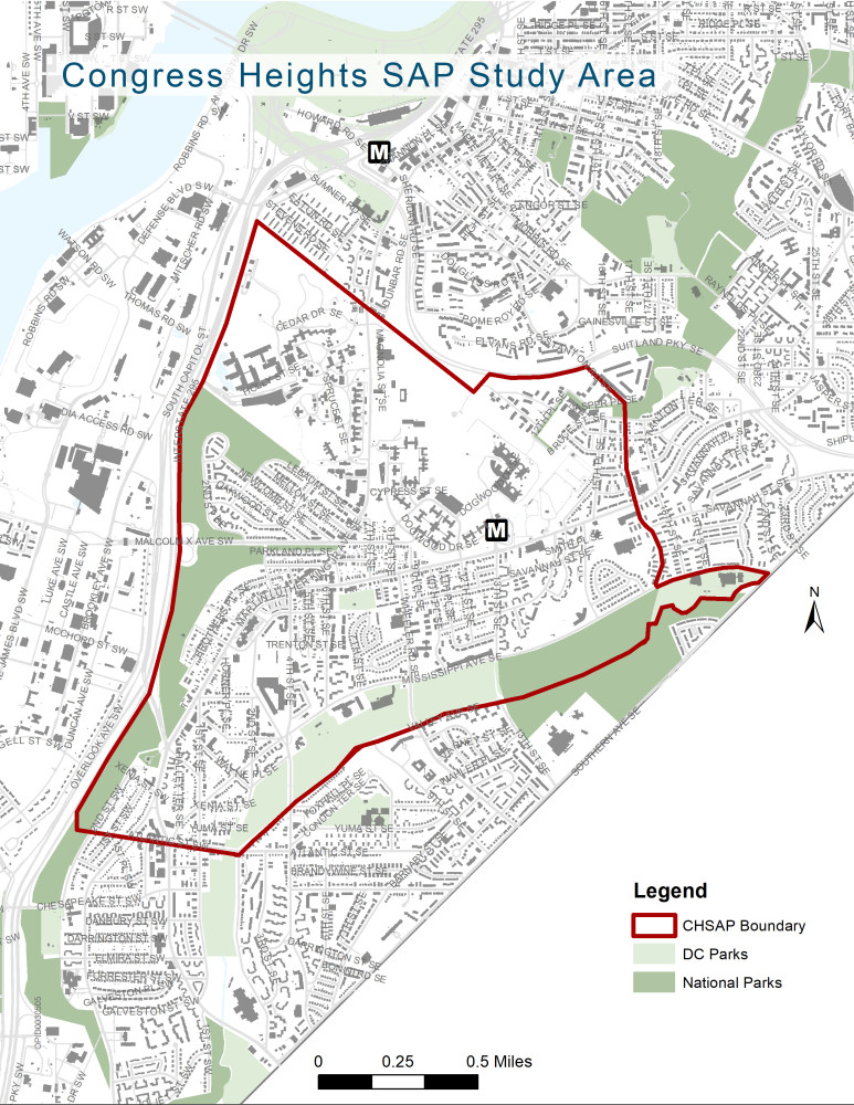
The Congress Heights Equitable Development Plan area extends along Martin Luther King, Jr. Ave SE, and along Alabama Ave SE. The site is bounded by: St. Elizabeths Campus to the north; Interstate 295 to the west; Stanton Road SE to the East; and Oxon Run and Atlantic St SE to the south. Click the image below to zoom in!
This Small Area Plan is intended to address land use, development, and place activation issues over a period of several years. For issues that are urgent, or related to public service programs we recommend reaching out to the appropriate agency:
- Housing: DC Housing Authority
- Family Services, Homelessness Prevention, and Medical Services: Department of Human Services
- Trash collection: Department of Public Works
We also recommend reaching out to the Mayor's Office of Community Relations:
Byron Johnson, Ward 8 Liaison
Phone: (202) 535-2182
Cell: (202) 549-6586
Email: Byron.Johnson@dc.gov
Kristina Washington, Ward 8 Liaison
Phone: (202) 230-8651
Email: Kristina.Washington@dc.gov
We are happy to connect you to the right agency if your need isn't addressed here, and are committed to passing along all feedback we hear to our partner agencies.
Community meetings will be held online for the foreseeable future and are accessible through this webpage, in the Events tab. Meetings will be live-streamed, and you can join the conversation by adding and responding to comments in the comment section or by calling in. Past meetings and comments will be archived here, as well, for viewing at any time.
This planning process has been designed to be responsive. The project team is continually checking the page for new comments and responses as the feedback we receive through surveys, correspondences and meetings help shape this planning process and will shape recommendations for the final plan. During each Town Hall, we will summarize the things we hear over the course of the plan in order to help the community reach a consensus around critical place-based issues.