U-6027: Greene Street - Rockingham
U-6027: Greene Street - Rockingham
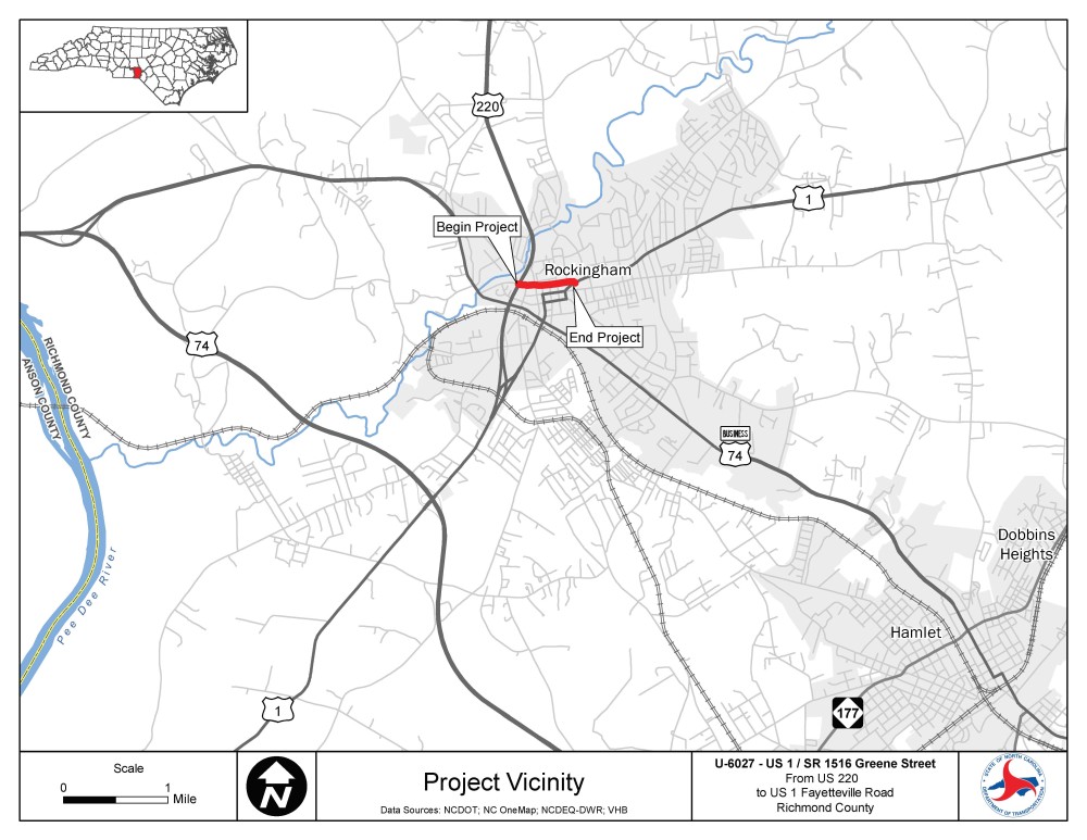
The N.C. Department of Transportation is proposing improvements along Greene Street (S.R. 1516) between U.S. 1 and U.S. 220, including a roundabout at the existing intersection of U.S. 1 and Greene Street.
Vicinity Map:
Interactive Study Area Map
Area in which environmental studies are performed for this project.
Project Highlights
The purpose of the proposed project is to provide a route to redirect large truck traffic onto Greene Street from the existing U.S. 1, which connects to downtown Rockingham. The proposed project is needed to address the large amount of truck traffic along U.S. 1.
The project proposes to make improvements to S.R. 1516 (Greene Street) from U.S. 220 to the existing U.S. 1 by:
- Widening and upgrading Greene Steet to include curb and gutter and sidewalks
- Realign Greene Street to become part of U.S. 1
- Upgrade the existing intersection of Greene Street and U.S. 1
Project History
A virtual public meeting was held in March 2021, with a subsequent affected property owners meeting held in-person at the project site in August 2021.
Since August 2021, the design was revised from a roundabout at the existing intersection of Greene Street and U.S. 1 to a T-intersection to reduce potential impacts to private properties and the surrounding historic district.
In May 2022 and July 2022, the design team was able to get concurrence from the State Historic Preservation Office with some additional right of way changes.
The revised design is available on the project website for public review and comment.
Public Involvement
Information will be provided to the public in a virtual format on this website. The public is encouraged to provide comments or share their thoughts regarding the proposed concept below.
Comments were due by Sept. 16, 2021
Click here for updated map 2022.
U-6027-Public meeting map_Greene_St_East_of_Caroline_St_to_US1
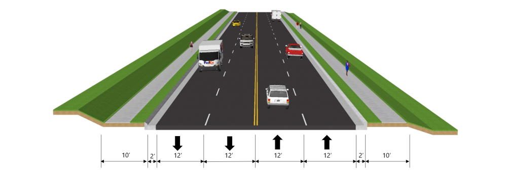
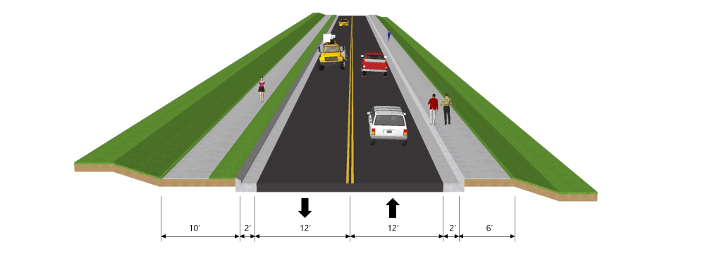
Typical Sections
Typical 1 (4-lane with curb and gutter and a sidepath on both sides) is Greene Street from US 220 to N. Lee Street.
Typical 2 (2-lane with curb and gutter and sidepath on one side and sidewalk on the other side) is Greene Street from N. Lee Street to US 1.
Project Funding
This project is listed as Project U-6027 in the N.C. Department of Transportation’s State Transportation Improvement Program (STIP) and is funded for $8.05 million.
Activity | Estimated Amount* | |
Project Development & Design | $ 650,000 | |
Property Acquisition | $1,200,000 | |
Utility Relocation | $ 500,000 | |
Construction Costs | $5,700,000 | |
Total Cost | $8,050,000** | |
* Estimated amounts are subject to change. Based on NCDOT STIP.
** Total Cost includes approximately $650,000 in previous year spending.
Project Timeline
Milestone | Date* |
Public Meeting and Comment Period | March 2021 |
Additional Public Comment Period | August 2022 |
Complete Environmental Document | August 2022 |
Right-of-way Acquisition Begins | FY 2023 |
Construction Begins | FY 2028 |
* Future dates are preliminary and subject to change
Project Comments:
All comments will be taken into consideration, regardless of submittal method.
Comments were submitted by September 16, 2021.
PROJECT CONTACT INFORMATION
Greg Davis
Project Engineer
NCDOT Highway Division 8
121 DOT Drive
Carthage, NC 28327
PROJECT CONTACT INFORMATION
Tim Goins
Project Consultant
VHB
940 Main Campus Drive, Suite 500
Raleigh, NC 27606
RESOURCES FOR PROPERTY OWNERS
Although the N.C. Department of Transportation works to minimize the number of homes and businesses displaced by a road project, it is inevitable, in many cases, that a certain amount of private property is needed. The following information explains right of way acquisition and answers questions about the process.
Right-of-Way Brochure Single Page Layout Folleto del Proceso de Adquisición de Bienes Raíces
Right-of-Way Frequently Asked Questions
Right of way Acquisition Process Videos


