 BR-0030: N.C. 28 over Cowee Creek - Macon County
BR-0030: N.C. 28 over Cowee Creek - Macon County
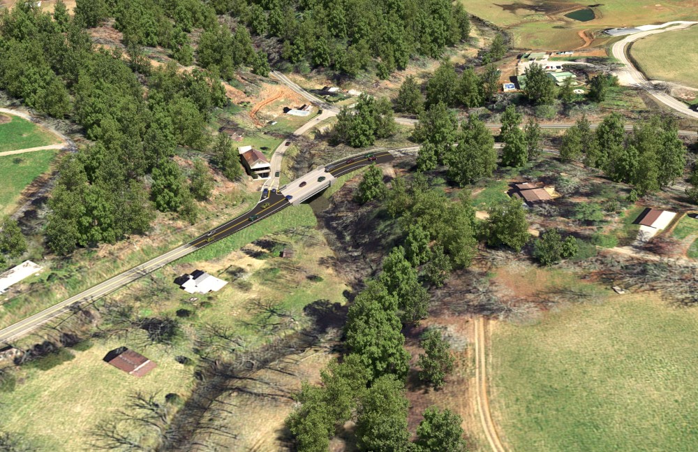
The N.C. Department of Transportation proposes to replace Bridge No. 85 on N.C. 28 over Cowee Creek north of Franklin in Macon County.
Project Highlights
The N.C. Department of Transportation proposes to replace Bridge No. 85 on N.C. 28 over Cowee Creek north of Franklin in Macon County.
The purpose of the project is to replace a structurally deficient bridge, meaning it has one or more defects that require attention. The bridge was built in 1921 and reconstructed in 1967. Bridge No. 85 is approaching the end of its functional life and needs to be upgraded with a facility that meets current standards.
Interactive Vicinity Map
Project Informational Video
A video explaining details about the project and maps can be viewed below.
Project Alternatives
NCDOT evaluated two alternatives for the proposed project and evaluated impacts to the environment and
potential costs. The main difference between the two alternatives is:
Alternative 1 would construct a new bridge at the existing location
Alternative 1 (with Detour) would construct a new bridge at the existing location with a temporary on-site detour
Alternative 2 would construct a new bridge south of the existing structure.
NCDOT has selected Alternative 1 (with Detour). This alternative would be constructed in stages and would require the closure of West Mills Road at its intersection with N.C. 28 during construction.
No off-site detours would be required for this project.
There are many community resources in the area. NCDOT sought to avoid or minimize impacts to these resources and other surrounding properties. Bridge No. 85 is historically significant, as is the historic district it is located in, the Cowee-West’s Mill Historic District. This district also includes other important historic resources such as the Will West House, C.N. West General Merchandise, and the former West Mill’s Post Office.
Alternative 1
Alternative 1 includes construction of a new bridge at the existing location and would be constructed in stages. During construction, traffic would be maintained on a temporary bridge structure south of the existing bridge.
A one-lane temporary on-site detour bridge would be built along the south side of the existing bridge parallel to carry eastbound NC 28 traffic.
Westbound traffic would be shifted and maintained along the southern section of the existing bridge.
Existing bridge removal would occur north to south followed by new bridge construction north to south.
Eastbound and westbound traffic would be shifted to the new section of bridge.
The detour bridge would be removed and the remainder of the southern section of the new bridge would be constructed. Once complete, eastbound and westbound traffic would be shifted to their final traffic patterns.
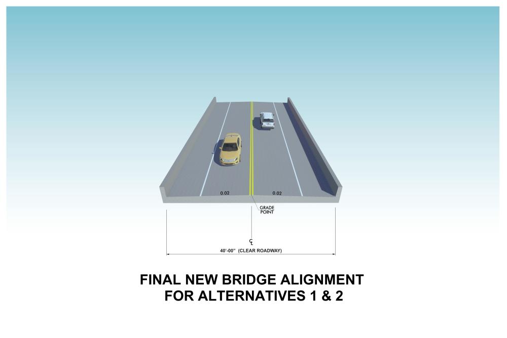
The new bridge would consist of two 12-foot travel lanes and 8-foot shoulders. Roadway improvements, including the tie-ins for the bridge approaches, will be incorporated into the project.
Project Maps and Handout
Download PDF of Alternative 1 (With On-Site Temporary Detour)
Download PDF of Project Handout
A video explaining how to read a public hearing or meeting map can be viewed below. The video contains information on colors used and symbology.
Project Funding
| Estimated Amount* |
|---|---|
Alternative 1 | $4,100,000 |
* Estimated costs are subject to change. Based on currently adopted NCDOT State Transportation Improvement Program (STIP).
Project Timeline
Milestone | Date* |
|---|---|
Final Environmental Document | July 2025 |
Right-of-Way | October 2026 |
Construction | March 2028 |
* Future dates are preliminary and subject to change
Project Contact
Lee Mai
NCDOT Project Manager
1582 Mail Service Center
Raleigh, NC 27699-1582
nc28-bridge85@publicinput.com
984-205-6615 code 4763
Resources For Property Owners
Although the N.C. Department of Transportation works to minimize the number of homes and businesses displaced by a road project, it is inevitable, in many cases, that a certain amount of private property is needed. The following information explains right of way acquisition and answers questions about the process.
Relocation Assistance Brochure Asistencia para Reubicación
Right-of-Way Acquisition Process Brochure Folleto del Proceso de Adquisición de Bienes Raíces
Right-of-Way Frequently Asked Questions
Page Last Updated: October 16, 2025