 Accessibility Information for Backcountry Trails
Accessibility Information for Backcountry Trails
King County Parks is working to make our backcountry trails more accessible. We’ve teamed up with Beneficial Designs, a trail and information mapping company, to collect trail information to help all users understand our trails, especially those with mobility needs who use adaptive devices. We’d love your feedback on the maps below and their usefulness for planning your hikes in King County parks and trails.
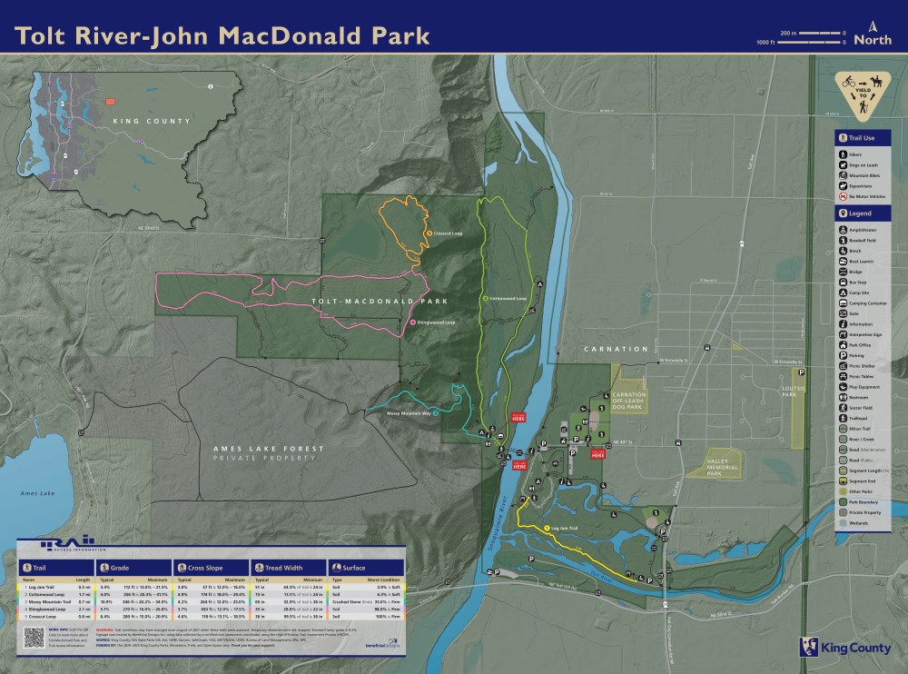
The above map is an example of one we would post online to show visitors the trails in a park, in this case, Tolt MacDonald Park in Carnation.
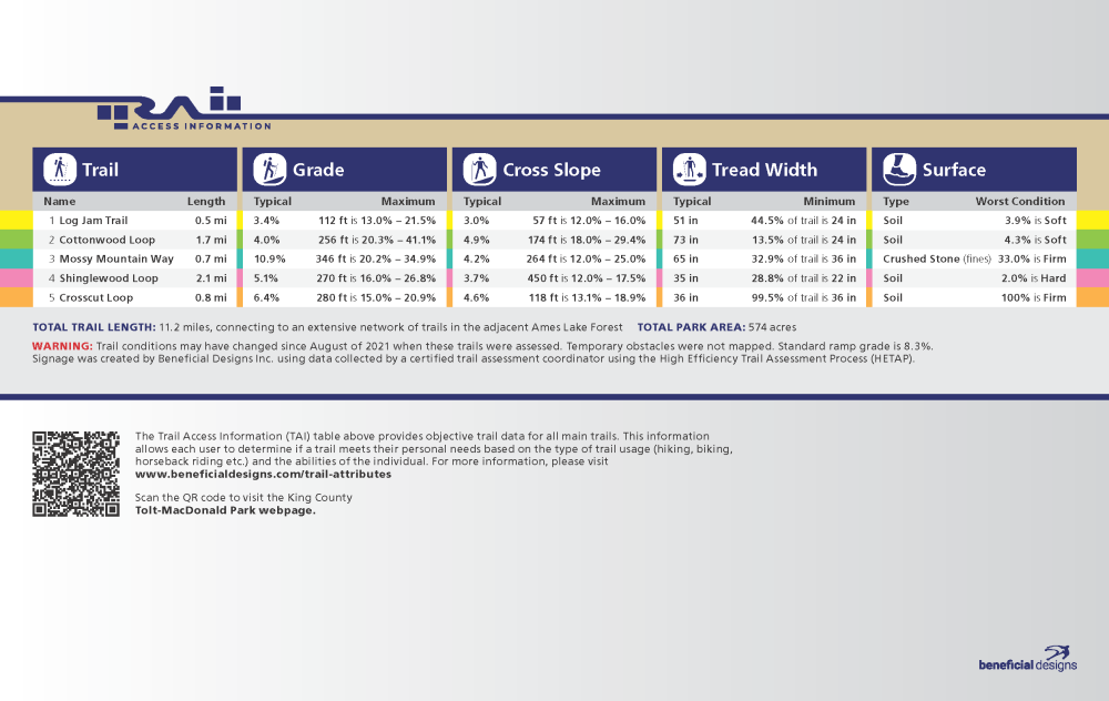
Below is the legend from the map showing various information for each trail:
- trail length,
- typical and maximum grade,
- cross slope,
- tread width,
- and surface type.
We hope this will help park visitors determine their level of accessibility.
First, review the trail map above (click to expand). Then, review the informational legend below and answer the following questions (click on the image and zoom in to see the different information).