 Route 19/460 (Tazewell County) Study Alternatives (BR-23-09)
Route 19/460 (Tazewell County) Study Alternatives (BR-23-09)
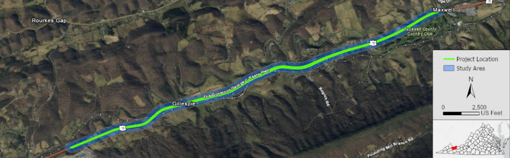
Welcome to the U.S. Route 19/460 (Governor George C. Peery Highway/Trail of the Lonesome Pine) Project Pipeline Study Survey
Please provide feedback on study alternatives to improve roadway safety within Tazewell County. Your feedback will help your local leaders determine whether to pursue future funding opportunities.
Introduction

Project Pipeline is a performance-based planning program to identify cost-effective solutions to multimodal transportation needs in Virginia. Through this planning process, projects and solutions may be considered for funding through SMART SCALE, revenue sharing, interstate funding, and other funding programs.
Tazewell County
Cumberland Plateau Planning District Commission
Vanasse Hangen Brustlin, Inc.
Background
This Phase 2 survey is intended to obtain public input on the alternatives under consideration to address the issues that were identified by the study team.