 Barracks Road Study Alternatives (CU-23-08)
Barracks Road Study Alternatives (CU-23-08)
Project Pipeline is a performance-based planning program to identify cost-effective solutions to multimodal transportation needs in Virginia. Through this planning process, projects and solutions may be considered for funding through programs, including SMART SCALE, revenue sharing, interstate funding and others.
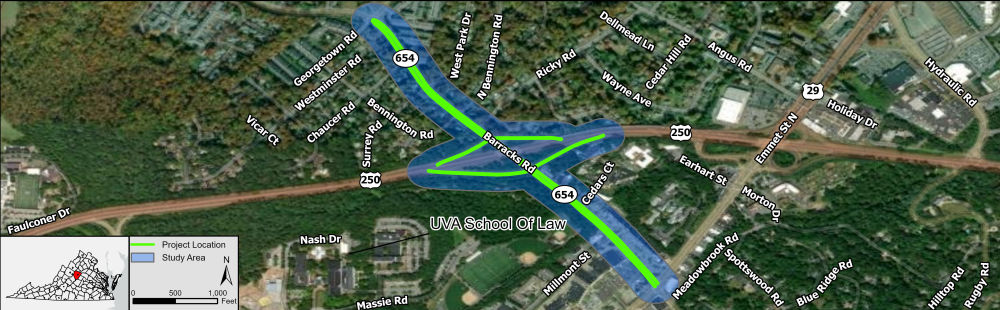
The purpose of this study is to identify project recommendations for the Route 654 (Barracks Road) corridor between Georgetown Road and U.S. 29 Business (Emmet Street) within Albemarle County and the City of Charlottesville. The corridor has several segments identified as very high safety needs, which will be a focus of the study. This study will focus on improving roadway safety and enhancing multimodal accessibility and connectivity for pedestrians, bicyclists, and transit users. The project recommendations that come from this study will be developed into funding applications for SMART SCALE Round 6 and other transportation funding programs.
The second phase of the study is underway. It involves developing alternatives to mitigate the identified needs. This survey provides the public an opportunity to see alternatives and provide input on them.

Study Partners
Albemarle County
City of Charlottesville
The University of Virginia
Thomas Jefferson Planning District Commission
RK&K
Study Location