Winter Island Park Pathway and Bank Restoration
Winter Island Park Pathway and Bank Restoration
Project Overview
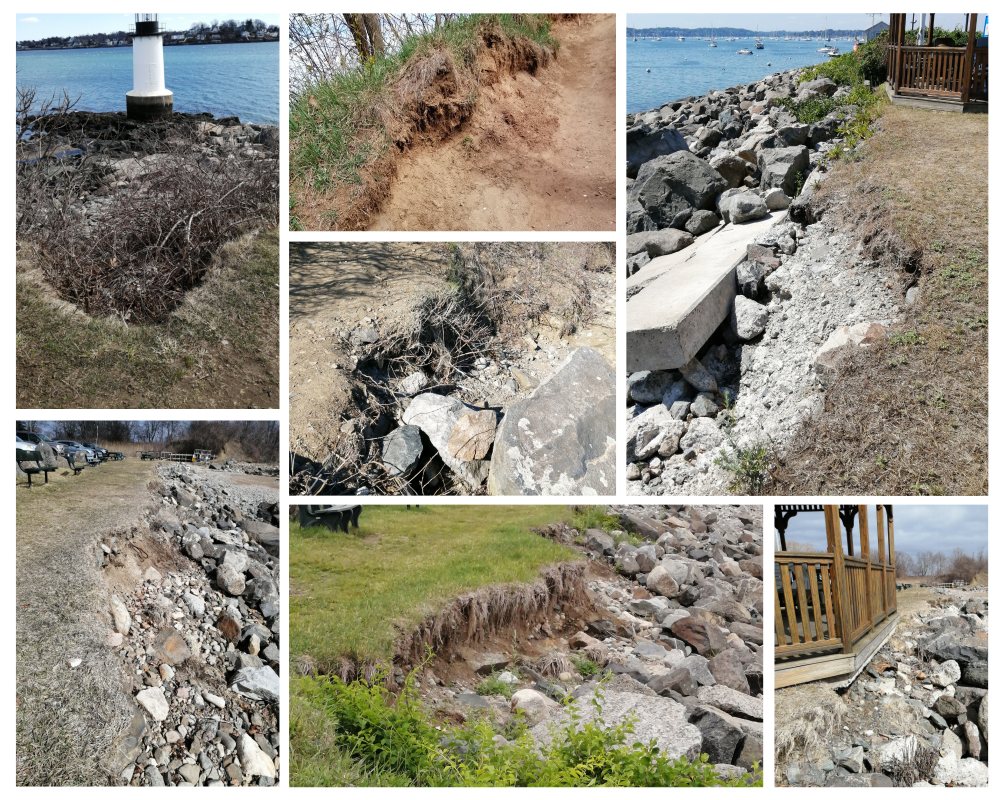
The Winter Island Park Pathway and Bank Restoration Project will help address the severe and ongoing issue of erosion of its pathways and coastal banks, resulting from its unconstrained use and from climate change. Coastal erosion, combined with excess invasive bittersweet, at Winter Island Park threatens the Park’s goals to “enhance its unique natural resources, preserve its historically significant properties, and increase the public’s access and enjoyment.”
The project will focus on managing the heavy, undirected pedestrian use of the coastal bank and assess how the eroding banks and pathways can best stabilized. Managing the year-round pedestrian use of the park is the critical first step. The project aims to find solutions to this problem through community engagement and physical actions at Winter Island Park. Additionally, the area will be evaluated to begin the ecological restoration of the coastal bank process.
Here are some photographs of the areas in queston. (Photos taken 2019 through Spring 2023)
Should you have any questions about this project, please reach out to the Project Manager, Christian Thiim, at cthiim@salem.com or Barbara Warren at bw@barbarawarrenenvironmental.com
***This project is largely funded by a Coastal Zone Management (CZM) Coastal Resilience Grant from the MA Executive Office of Energy and Environmental Affairs***
StoryMap below can also be viewed directly on: https://storymaps.arcgis.com/stories/127af61ac4ec43528db4df213134fa62