 Fayetteville Center City Connection-North
Fayetteville Center City Connection-North


Fayetteville Center City Connection- North
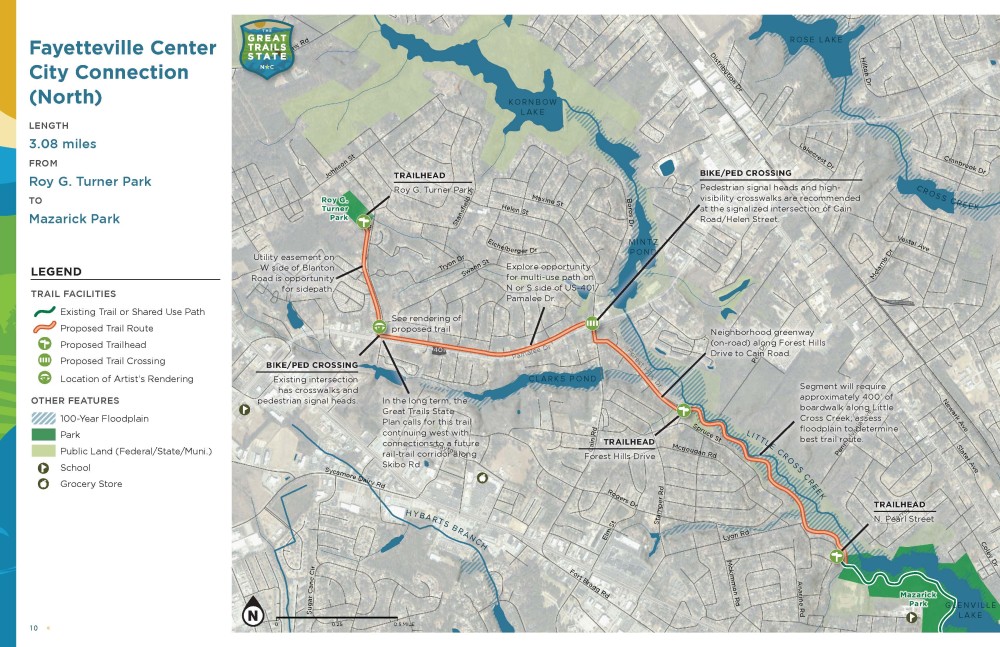
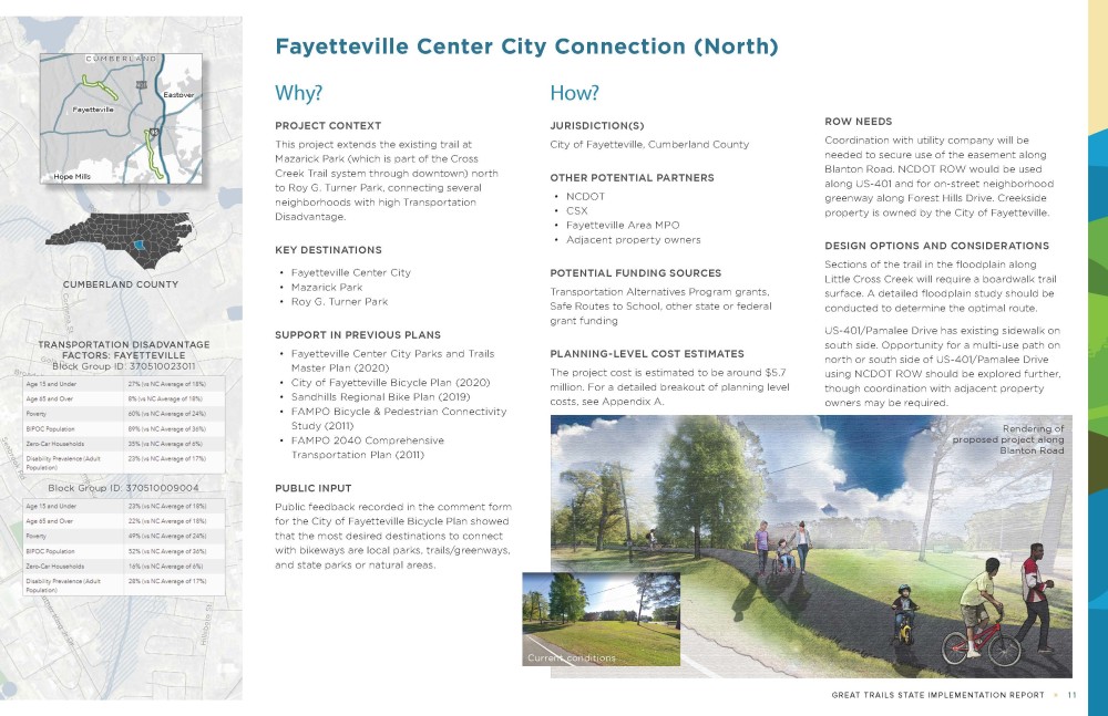
This project extends the existing trail at Mazarick Park (which is part of Cross Creek Trail System through downtown) north to Roy G. Turner Park, connecting several neighborhoods with high Transportation Disadvantage.
Please review the map, description, and other information and answer the survey questions below.
To view a higher resolution map and project information sheet, click the map below, or click here.
Step 1
How supportive are you of this trail recommendation?
Please provide any reasoning behind your level of support.
If you have any comments about the trail alignment, please leave a comment on the map. To leave a comment, drag an icon from the top of the map onto the location. You may also draw lines.
How often do you use greenways, trails, or multimodal infrastructure (bike lanes, sidewalks, etc.)?
Please enter your home zip code.
This is hidden text that lets us know when google translate runs.