Town of Rush Pedestrian/Bicycle Safety & Connectivity Plan - Outreach #2
Town of Rush Pedestrian/Bicycle Safety & Connectivity Plan - Outreach #2
The first of the three public meetings was held to solicit input on existing and planned conditions and associated needs. The input from this initial public meeting will influence the development of potential alternatives. The second public meeting will be to present the draft recommended alternatives for community feedback. Comments received at this second public meeting will be considered by the PAC (Project Advisory Committee) when evaluating and selecting recommended strategies to be included in the draft Pedestrian Safety and Connectivity Plan. In addition, the final report will be presented to the Town Board, offering a third public opportunity for the community to be involved in the process.
Draft Recommendations Presented at Public Meeting #2
November 20, 2024
Powerpoint Presentation in PDF Format
Rush West Rush Road/15A Intersection
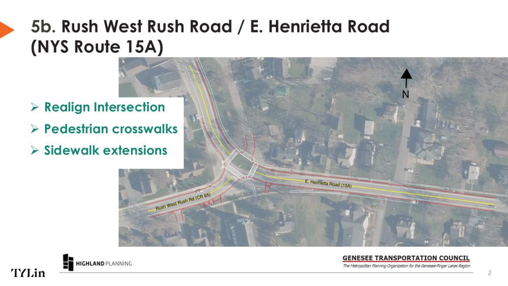
Intersection of NYS Route 15A (E. Henrietta Road and Rush West Rush Road
This recommendation proposes realigning and converting the existing channelized intersection into a two-way stop configuration at Park Lane, with stop controls on Rush West Rush Road and Park Lane. It includes high-visibility crosswalks with advanced signage on all four approaches. It also proposes extending sidewalks along Route 15A to the north and east.
Text version: The image above shows an aerial view of the Route 15A and Rush West Rush Road intersection in Rush. North is at the top of the image. The red lines on the map show the curb lines/edge of pavement and modified driveways. The white lines show the back of sidewalk.
Route 251/15A Intersection
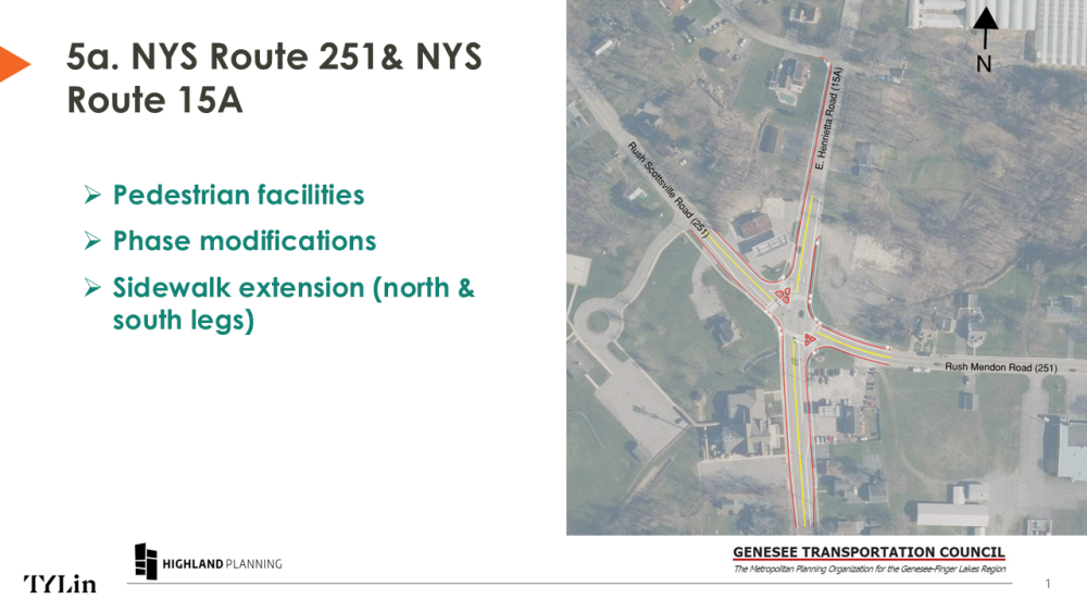
Intersection of NYS Route 251 (Rush Scottsville Road/Rush Mendon Road) & NYS Route 15A (E. Henrietta Road)
This recommendation adds pedestrian features to the signalized intersection on all four sides, including a dedicated crossing phase with “walk/don’t walk” icons, countdown timers, and audible-tactile signals that provide audible alerts and buttons with arrows to guide pedestrians. New sidewalks are proposed along the north and south legs, on E. Henrietta Road, to provide connectivity and enhance access.
Text version: The image above shows an aerial view of the Route 15A and Route 251 intersection in Rush. North is at the top of the image. The red lines on the map show the curb lines/edge of pavement. The white lines show the back of sidewalk.
Pedestrian Improvements in the Hamlet
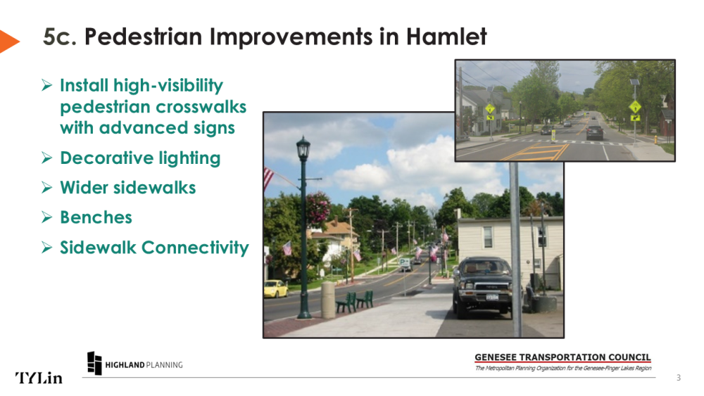
This recommendation proposes adding high-visibility pedestrian crosswalks with advanced signs to bring more attention to the Lehigh Valley Trail crossing NYS Route 15A. Additional improvements include wider sidewalks, benches and decorative lighting.
Text version: The image above shows examples of highways with a high-visibility pedestrian crosswalk, lighting, a wide sidewalk and benches.
Improvements to the Lehigh Valley Multi-use Trail
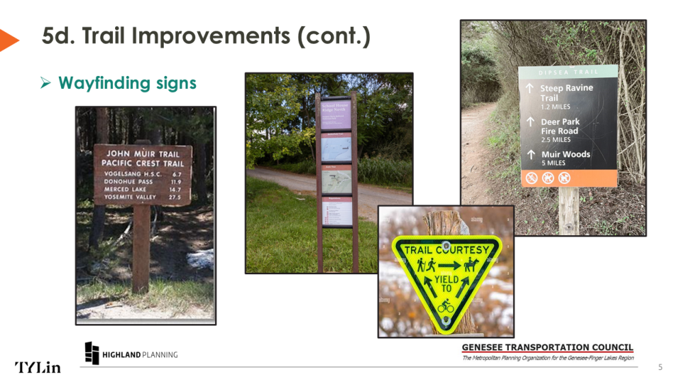
This recommendation proposes upgrading the existing trail surface condition of stone and dirt to fresh stone dust and introducing rural trailhead treatments including bicycle racks, benches and wayfinding signs.
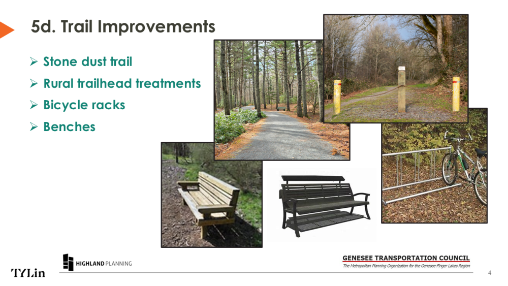
Text version: The images above shows examples of trail amenities including a stone-dust surface, bike racks, benches and examples of wayfinding signs.
Mail Delivery and Brush Removal
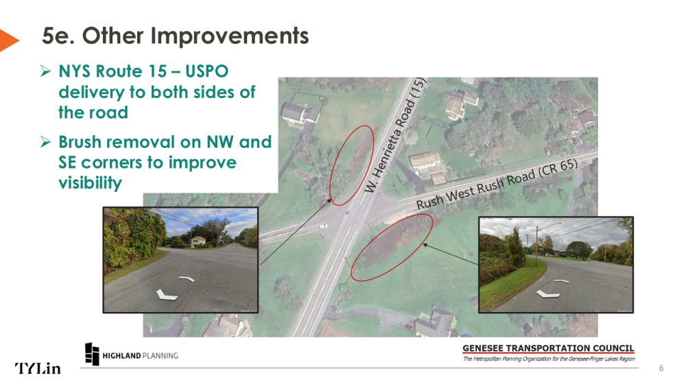
This recommendation is to partner with the United States Post Office to offer mail delivery on both sides of the road along NYS Route 15 (W. Henrietta Road,) elimating the need for people to cross the road to access mailboxes.
Another recommendation is to remove overgrown brush at two specific locations to increase the line of sight. One location is on the northwest and southeast corners at the intersection of NYS Route 15 (W. Henrietta Road) and Rush West Rush Road as well as NE corner of Route 251 (Rush Mendon Road) and Pinnacle Road.
Text version: This image shows an aerial view of the intersection of W. Henrietta Road (Rt 15) and Rush West Rush Road with insets of existing conditions depicting overgrown brush and limited lines of sight.
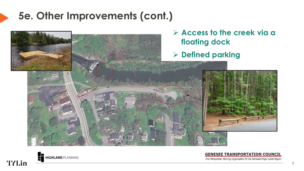
This recommendation proposes improving and designating parking areas on the Lehigh Valley trailhead and at the Veterans Memorial Park to help create smooth circulation and an identifiable place for visitors to park.
Another recommendation is adding a floating dock to provide defined space for kayakers to access Honoeye Creek.
Text version: This image is an aerial view map showing the park, Honeoye Creek and insets of a floating dock and defined parking areas.
