Route 221 Corridor Study
Route 221 Corridor Study

This study is assessing potential operational and safety improvements for the Route 221 corridor in Bedford County, Virginia, from Perrowville Road to Graves Mill Road. Route 221 serves as an east-west major arterial roadway connecting the residential areas to commercial areas and employment centers. This corridor has been identified to have safety and operational issues during peak periods (defined as 6am-9am and 4pm-7pm). The study will also address bicycle, pedestrian, and transit needs along the corridor. The goal of this study is to develop a series of solutions to address the arterial congestion and safety concerns along the subject corridor.
Study Area
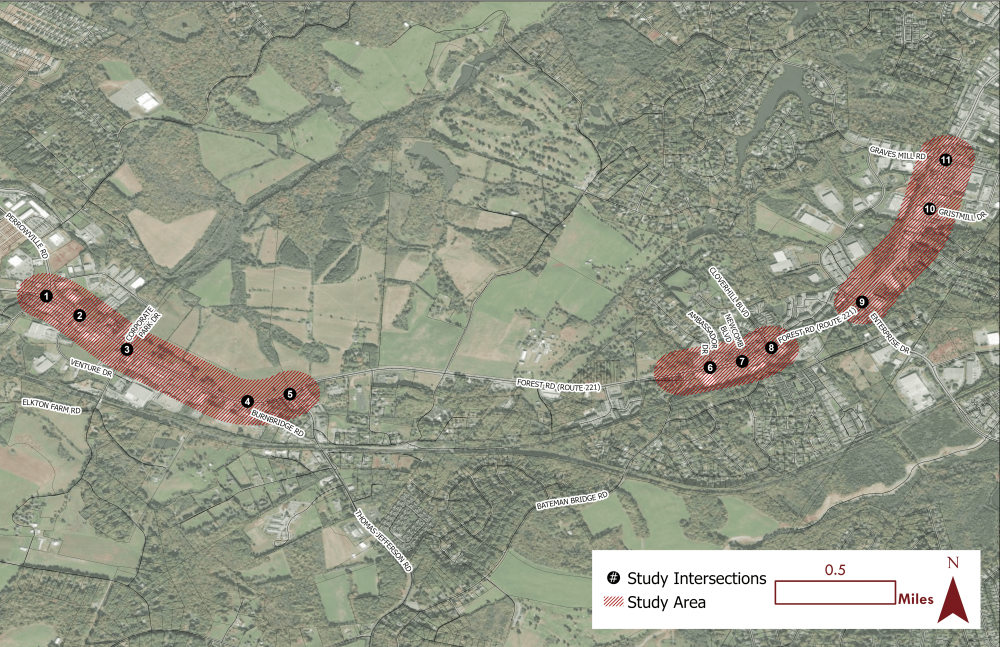
The study area extends from Perrowville Road to Graves Mill Road focusing on the shaded areas and numbered intersections below.
Rank what is the most important issue to you along Route 221.
Drag your top items in order of importance.
Which of the following safety issues concern you? (Check all that apply.)
Do you experience congestion in the study area? If so, where and when? (Check all that apply.)
What mobility issues do you typically experience when using the study area? (Check all that apply.)
When do you typically experience mobility issues in the study area? (Check all that apply.)
How often do you travel along the study area?
When do you typically travel in the study area? (Check all that apply.)
Why do you travel along the study area? (Check all that apply.)
What mode(s) of travel do you use when traveling along the study area? (Check all that apply.)
What multimodal facilities are needed along this study area? (Check all that apply.)
Please drop a pin within the study area and share your concerns.
Study Area
The study area extends from Perrowville Road to Graves Mill Road focusing on the shaded areas and numbered intersections below.