BP2-R024-Trent River Bridge Replacement-Craven County
BP2-R024-Trent River Bridge Replacement-Craven County
The N.C. Department of Transportation is proposing to replace the bridge on Trent Woods Drive over Trent River/Wilson Creek in Craven County.
Interactive Study Area Map
Project Overview
The N.C. Department of Transportation proposes to replace the bridge on Trent Woods Drive over the Trent River/Wilson Creek in Craven County. Trent Woods Drive consists of two 9-foot travel lanes, with 2-foot shoulders and a speed limit of 35 miles per hour (mph). The bridge has a deck width of 26.6 feet.
There are two project design alternatives which are highlighted below.
Alternative 1 consists of a 36.5-foot-wide bridge that includes two 11-foot-wide travel lanes with 4-foot paved shoulders on both sides of the travel lanes. A 6.5-foot-wide sidewalk is proposed along the north side of the bridge. The sidewalk would tie into the existing sidewalk located on the north side of Trent Woods Drive (S.R. 1213).
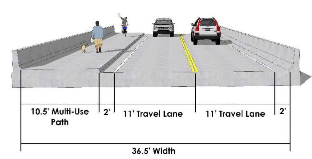
Alternative 2 consists of a 36.5-foot-wide bridge that includes two 11-foot-wide travel lanes with 2-foot paved shoulders on both sides of the travel lanes. A 10.5-foot-wide multi-use path (MUP) is proposed along the north side of the bridge. The multi-use path would tie into the existing sidewalk located on the north side of Trent Woods Drive (S.R. 1213).
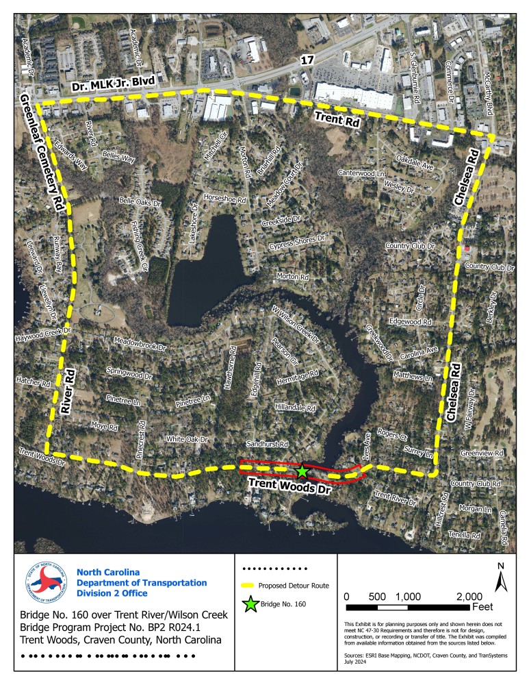
A five-mile detour is proposed during construction. This detour begins west of Trent Woods Drive, travels north on River Road and Greenleaf Cemetery Road, east on Business U.S. 17, southeast on Trent Road, south on Chelsea Road and concludes to the west on Trent Woods Drive.
Detour Map
Typical Section for Alternative 1 Trent Woods Drive view
Typical Section for Alternative 1 bridge view
Typical Section for Alternative 2
Trent Wood Drive view
Typical Section for Alternative 2
Bridge view
Project Funding:
Activity | Costs* |
Right-of-Way Acquisition | $ 80,000 |
Construction | $ 1.66 Million |
| Total Cost | $ 2.46 Million |
*As shown in currently adopted State Transportation Improvement Program. Subject to change.
Project Timeline:
Milestone | Date* |
Environmental Document | November 2023 |
Right-of-Way Acquisition Begins | Spring 2025 |
Construction Begins | Spring 2027 |
* Future dates subject to change.
Project Comments:
NCDOT accepts comments throughout all planning, design, and construction phases of project development.
All comments will be taken into consideration, and carry equal weight, regardless of submittal method.
To submit comments for consideration during the current phase of project development
were to be submitted before September 4, 2024.
The public is encouraged to leave comments using this webpage, email, or phone number.
Email: TrentRiver-BridgeReplacement@publicinput.com
Phone Number: (984) 205-6615 Code: 5384
Project Contact Information
Allison McAuliffe, PE
Project Engineer
NCDOT Highway Division 2
1037 W. H. Smith Blvd
Greenville, N.C. 27834
Project Contact Information
Alex McCarn
Consultant Transportation Planner
TranSystems
1 Glenwood Avenue, Suite 600
Raleigh, N.C. 27603
Title VI Feedback
To ensure we’re hearing from a broad set of voices, would you be willing to share (completely anonymously) some information about yourself?
If so, please click here: https://publicinput.com/NCDOT-Title-VI-Form
RESOURCES FOR PROPERTY OWNERS
Although the N.C. Department of Transportation works to minimize the number of homes and businesses displaced by a road
project, it is inevitable, in many cases, that a certain amount of private property is needed. The following information explains right
of way acquisition and answers questions about the process.
Right-of-Way Brochure Single Page Layout Folleto del Proceso de Adquisición de Bienes Raíces
Right-of-Way Frequently Asked Questions
Right-of-Way Acquisition Process Videos


