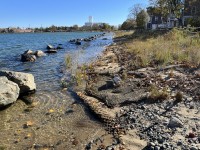
 Collins Cove to Willows Resilience Study
Collins Cove to Willows Resilience Study
The project goal is to conduct a resilience study for the Collins Cove to Willows area of Salem, with an emphasis on assessing vulnerability and risk of the study area to coastal and inland flooding. The study focuses on city-owned property including roadway/right-of-way infrastructure, linear parks/bike paths, Collins Cove Park, Collins Cove Beach, Memorial Park, Salem Willows Park, and Winter Island Park.
The project objectives include:
- Review and apply coastal flooding projections;
- Examine overland flooding under current and future conditions (including development of a dynamic hydraulic/hydrologic model for the study area);
- Conduct a stakeholder engagement process to receive and collect feedback on current vulnerabilities and risks and identify recommended measures that the City can implement to increase the resilience of this area to climate change;
- Develop resilient options for the city parks and road networks in the study area;
- Develop an emergency response and evacuation plan for residents to use during flood events;
- Develop a resilient coastal parks toolkit; and
- Prepare a Collins Cove to Willows Resilience study report that summarizes the findings from the study and includes an implementation plan.
***This project is being funded in large part by a Municipal Vulnerability Preparedness (MVP) program Action Grant through the MA Executive Office of Energy and Environmental Affairs***
Third Community Meeting Recording
This meeting was held as a hybrid meeting on Tuesday, May 23rd 7:00-8:00pm
Slides for the meeting are included in the documents at the bottom of this page.
Second Community Meeting Recording
This meeting was held virtually on Monday, February 27th at 7PM, a link to the recording is posted below.
Slides for the meeting are included in the documents at the bottom of this page.
The poll questions from this webinar have been included below on this Public Input page - we'd love your feedback!
Also, here is a link to a video of the Salem Sound Coastwatch presentation with Woods Hole Group about the Massachusetts Coast Flood Risk Model (MC-FRM) in case you'd like more information on that model
Slides from the first public community meeting (Nov 29th) are included in the documents below.
And here is a link to Salem Access TV's recording of the presentation given at the first public community meeting:
https://www.youtube.com/watch?v=CPHtVV-YMjQ
(or scroll down on this page to play the video)