欢迎

2020 年,伊瑟阔溪暴发洪水,对附近的房屋和公共基础设施造成重大损毁。金县积极应对,作为金县洪水防控区的服务提供者,正在努力提高防洪能力。

金县正在绘制第一张伊瑟阔溪河道迁移区地图。河道迁移区地图标识出河流或河溪日后可能改道的位置。这些地图帮助公众做出保护自己、家人及其财产安全的决策。

这些地图还将为当地政府提供用于制定和许可决策的准确数据。

河道迁移是什么?

河道迁移是一个自然发生但有潜在危险的过程。由于河岸逐渐侵蚀或河流改道,因此河道可以在洪泛平原上移动。该过程可能导致河岸后退或完全移动,并可能引发岸坡崩塌。它还会导致木头和泥沙移动,沉积物变化和集聚。这个过程可能威胁房屋、道路和基础设施,改变洪水模式。
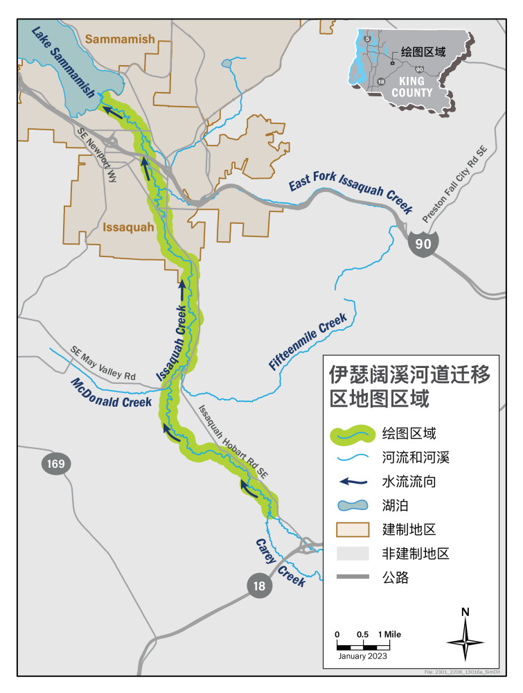
如需接收有关该研究的最新信息,请注册项目电子邮件列表

伊瑟阔溪河道迁移区研究区域

我们将在金县非建制地区和伊瑟阔市研究 13 英里长的伊瑟阔溪。研究区域起始于霍尔德溪(Holder Creek)与凯里溪(Carey Creek)的交汇点,终止于伊瑟阔溪汇入瑟马米什湖(Lake Sammamish)的出水口。

Green highlights the channel migration zone study area on Issaquah Creek.

complete
complete
Channel migration zone study begins

Spring 2022

live
live
Data collection and field work

Fall 2022 - Summer 2023

planned
planned
Data analysis and draft study prepared

2023

planned
planned
Draft map made available to the public

Early winter 2024

planned
planned
Public meeting and public comment period opens

Winter 2024

planned
planned
State Environmental Policy Act (SEPA) comment period closes

Spring 2024

planned
planned
Public comment period for draft map closes

Spring 2024

planned
planned
Map submitted to Department of Local Services Permitting

Spring 2024

planned
planned
Final map is adopted, and channel migration public rule is amended

Summer 2024

planned
planned
Maps become effective

Summer 2024