Issaquah Creek 河道遷移區研究
Issaquah Creek 河道遷移區研究
歡迎
Issaquah Creek 沿岸地區在 2020 年所發生的洪水對附近房屋和公共基礎設施造成重大損失。為了因應該次洪水,King County 政府作為 King County 洪水管制區的服務提供者目前正努力改善此地區抵禦洪水的能力。
King County 目前正在製作 Issaquah Creek 首份的河道遷移區地圖。河道遷移區地圖可找出一條河川或溪流在未來可能會發生遷移的位置。這些地圖可協助民眾作出決定以保護自己、家人及財產的安全。
這些地圖也可為當地政府提供精確的資料,以用於作出與開發和核發許可有關的決定。
什麼是河道遷移?
河道遷移是一種天然但具有潛在危險性的過程。河道可能會因河岸逐漸受到侵蝕或者因河流突然改道而在其洪氾區移動。此過程可能會導致河岸後退或完全移動,也可能會引發土石流。此過程也可能會導致木屑和碎石移動,以及溪流沉積物移動和聚積。此過程可能會使房屋、道路和基礎設施受到威脅,並改變洪水發生的模式。
如欲收到有關此研究的最新資訊,請註冊加入計劃的電子郵件名單。
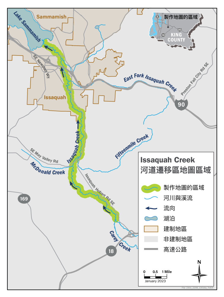
Issaquah Creek 河道遷移區研究區域
我們將會研究位於非建制 King County 和 City of Issaquah 之 13 英里的 Issaquah Creek。研究區域從 Hoder Creek 和 Carey Creek 的交匯處開始,並在 Issaquah Creek 流入 Lake Sammamish 處結束。
This is hidden text that lets us know when google translate runs.