Issaquah Creek Channel Migration Zone Map
Issaquah Creek Channel Migration Zone Map
King County is studying channel migration on Issaquah Creek. Channel migration is a type of flood hazard. Use the tabs above to learn about the study and future channel migration zone map. Provide your input to help our community be more prepared for future flood events.
Interpretation and translation services are available at no cost to you. If you need them, please contact us at JRadloff@kingcounty.gov or 206-263-6844.
English | 简体中文 (Chinese, Simplified) | 繁體中文 (Chinese, Traditional)| Español (Spanish)
Welcome
Welcome
Flooding along Issaquah Creek in 2020 caused significant damage to nearby homes and public infrastructure. In response, King County, as service provider to the King County Flood Control District, is working to improve flood resilience.
King County is developing the first channel migration zone map of Issaquah Creek. Channel migration zone maps identify where a river or creek could move in the future. The maps help people make decisions that keep themselves, their families, and their properties safe.
The maps will also provide local governments with accurate data to use in development and permitting decisions.
What is channel migration?
Channel migration is a natural, but potentially dangerous process. River channels can move across their floodplains, either due to gradual bank erosion or when a river jumps course. The process can cause riverbanks to recede or move completely and can trigger landslides. It can also cause wood and debris to move and sediment deposits to shift and build up. The process can threaten homes, roads and infrastructure, and change flooding patterns.
To receive updates on this study, sign up for the project email list.
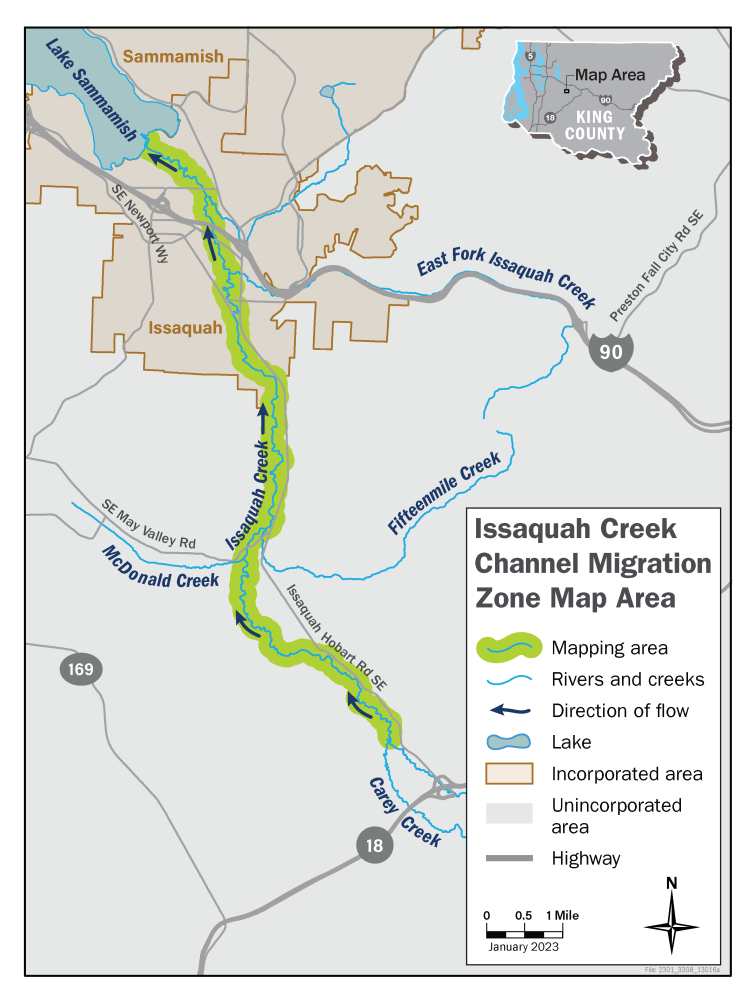
Issaquah Creek Channel Migration Zone Study Area
We will study 13 miles of Issaquah Creek in unincorporated King County and the City of Issaquah. The study area starts at the meeting point of Holder and Carey Creeks and ends at the Issaquah Creek outlet into Lake Sammamish.