Issaquah Creek Flood Map Update
Issaquah Creek Flood Map Update
King County is studying flooding on Issaquah Creek. Use the tabs above to learn about the study and future flood maps. Provide your input to help our community be more prepared for future flood events.
Interpretation and translation services are available to you at no cost. If you need them, please contact us at (twinjum@kingcounty.gov) or 206-263-0174.
English | 简体中文 (Chinese, Simplified) | 繁體中文 (Chinese, Traditional)| Español (Spanish)
Welcome
Welcome
Flooding along Issaquah Creek in 2020 caused significant damage to nearby homes and public infrastructure. In response, King County, as service provider to the King County Flood Control District, is working to improve flood resilience.
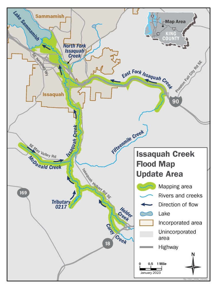
King County is studying flooding on Issaquah Creek and six creeks that flow into it. We’ll use this information to update flood maps for the area. New maps will better represent flood hazards to nearby communities. The maps will also help individuals make decisions that keep themselves, their families, and their property safe.
To receive project updates, sign up for the project email list.
Issaquah Creek Flood Study Area
We will study 28 miles of Issaquah Creek and portions of six small creeks that flow into it. The small creeks include East Fork Issaquah Creek, North Fork Issaquah Creek, McDonald Creek, Carey Creek, Holder Creek, and an unnamed creek 0217 in the Four Lakes area. The study area is within unincorporated King County and the City of Issaquah.