製作 Issaquah Creek 洪水危害地圖
製作 Issaquah Creek 洪水危害地圖
King County 目前正在製作 Issaquah Creek 沿岸洪水和河道遷移危害的地圖。這些地圖將可協助 King County 和 City of Issaquah 政府更妥善地管理社區洪水風險。立即透過線上瞭解詳情。
我們預計將在 2024 年分享洪水危害地圖的草圖。我們將會在製作地圖的整個過程中持續為您提供最新資訊。
如欲瞭解詳情,請致電 206-477-4812 與 King County 河川與洪氾區管理部聯絡。
我們可免費為您提供口譯和翻譯服務。如果您需要口譯和翻譯服務,請致電 206-477-4812 與我們聯絡。
歡迎
Issaquah Creek 沿岸地區在 2020 年所發生的洪水對附近房屋和公共基礎設施造成重大損失。為了因應該次洪水,King County 政府作為 King County 洪水管制區的服務提供者目前正努力改善此地區抵禦洪水的能力。
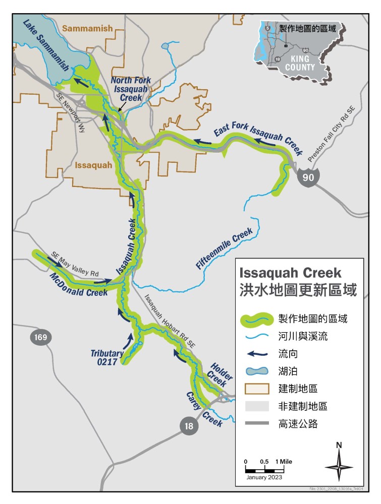
King County 政府目前正在研究 Issaquah Creek 以及流入 Issaquah Creek 之六條溪流的洪水問題。我們將會使用這些資訊來更新此地區的洪水地圖。新地圖將會更準確地反映附近社區的洪水危害。這些地圖也可協助民眾作出決定以保護自己、家人及財產的安全。
如欲收到計劃最新資訊,請註冊加入計劃的電子郵件名單。
我們將會研究 28 英里的 Issaquah Creek 以及流入 Issaquah Creek 之六條小溪流的其中一部分。這些小溪流包括 East Fork Issaquah Creek、North Fork Issaquah Creek、McDonald Creek、Carey Creek、Holder Creek, 以及位於 Four Lakes 地區一條沒有名稱的溪流 0217。研究地區位於非建制 King County 及 City of Issaquah 範圍內。