欢迎
2020 年,伊瑟阔溪暴发洪水,对附近的房屋和公共基础设施造成重大损毁。金县积极应对,作为金县洪水防控区的服务提供者,正在努力提高防洪能力。
金县正在研究有关伊瑟阔溪和流入伊瑟阔溪的六条河溪的洪水情况。我们将使用此信息来更新该区域的洪水地图。新地图将更好地反映附近社区的洪水灾害。这些地图还将帮助公众做出保护自己、家人及其财产安全的决策。
如需接收项目最新信息,请注册项目电子邮件列表。
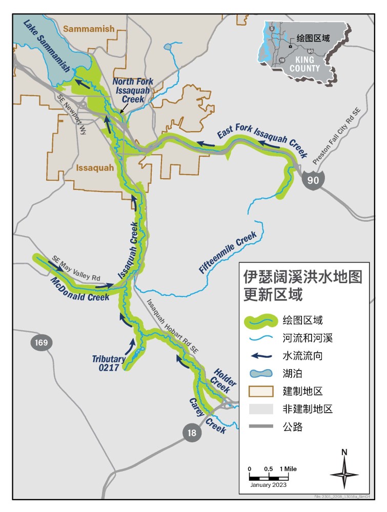
伊瑟阔溪洪水研究区域
我们将研究 28 英里长的伊瑟阔溪和流入伊瑟阔溪的六条小河溪的地段。小河溪包括东福克伊瑟阔溪(East Fork Issaquah Creek)、北福克伊瑟阔溪(North Fork Issaquah Creek)、麦当劳溪(McDonald Creek)、凯里溪(Carey Creek)、霍尔德溪(Holder Creek),以及四湖区域的一条未命名河溪 0217。研究区域位于金县非建制地区和伊瑟阔市内。
This is hidden text that lets us know when google translate runs.